CDT mile 1053.8, miles hiked 18.8
The highest point on the CDT is finally done time to get to Canada
We awoke to a calm breeze and cold air, I tried to ignore my alarm but Buttercup was only feet away sleeping in the lee of my tent and when I rustled he said good morning and it was time to get up. After our standard routine of eating, packing, pooping, and getting ready for the day we were off.

coming down from Argentine Peak
We could see what lay before us, a ridge of 6 miles up and down various peaks that would then connect us back to the CDT and over more peaks on our way to Gray’s peak the highest point on the CDT, at 14,270′. The first climb was a good wake up, we worked our way across Argentine spine which was that a spine and a knife edge. Each climb was a bit hairier than the previous one but we took our time and picked our way through the rocks. We did have some fun passing old mines and exploring what was left of the buildings and the old mine shafts.
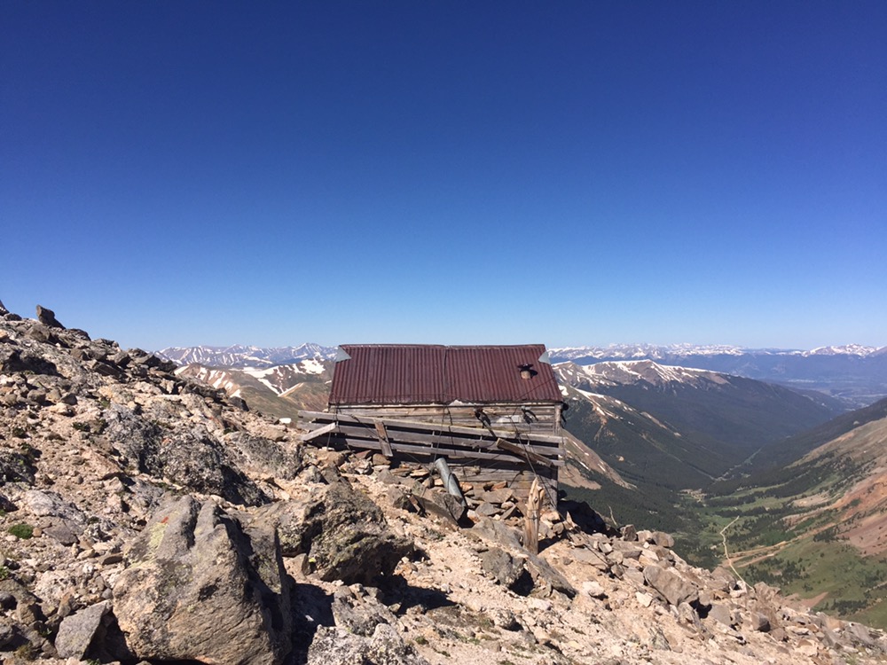
The miner’s hut along Argentine Spine
Buttercup got ahead of us and eventually, we saw him in the saddle below Argentine Mountain. We met him there for a snack and he said he wanted to push on today on his own do both Grays and Torres peaks and would meet us later at the parking lot. He took off and left Cheezy and me to our own devices.
The two of us climbed and it seemed like all we did was climb. We knew we had to climb Mt Edwards on our way but neither of us realized it was 13,905′. When we reached the top we ran into two mountaineers who told us about seeing Buttercup and how Mt Edwards was the centennial 13’er of Colorado. We said our goodbyes and started along a knife edge towards Gray’s Peak.
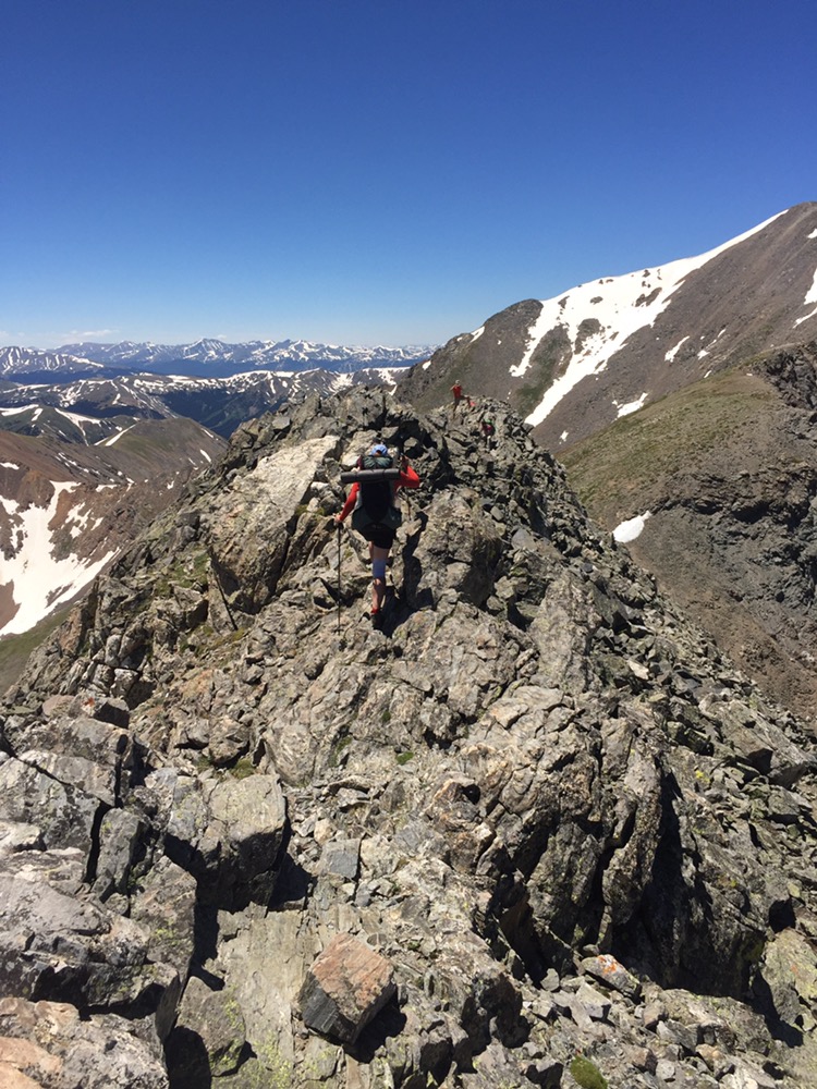
Cheezy making her way along the knife edge
As we worked our way along the knife edge which was as scary as anything I did on the Sierra High Route last year, we came to the end of one ridge to start the other and we met two-day hikers who were lost. We told them where they were and they asked if we could lead them, we agreed to. The one guy was starting out on his own adventure to climb all 75 14’ers in the lower US in 75 days, not a good way to start being lost on day one, but I think he learned from his mistakes.
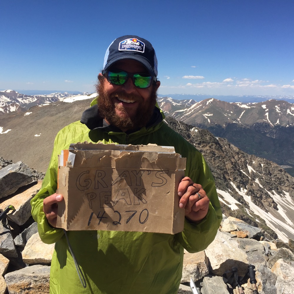
We grinded our way along the ridge line and finally reached an actual trail on Gray’s peak. We worked our way up slowly and finally at 2:30 after only hiking 9 miles since 6am we reached the summit. Photos were taken and snacks were chewed before we started our descent.
Cheezy and I chatted on our way down and then found Buttercup waiting for us in the parking lot. The three of us kept going after catching up and walked the road to I-70. When we reached the road Teresa was there waiting for us with our resupply of food and cheeseburgers from McDonald’s. We told her of our hike, ate some great burgers and loaded up food and fuel for the next 77 miles to Grand Lake.
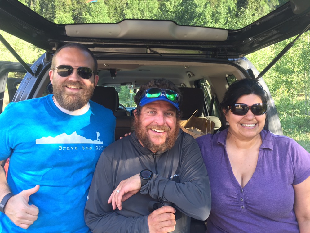
a CDTC resupply thanks to Chad and Teresa
We walked the paved path that parallels the highway and finally made camp a hair short of the underpass. Here I lay now enjoying the serenity. Nothing says wilderness like a power line and highway.