Spike Camp to Cow Creek Bridge on the banks of the Imnaha River 19.87miles, 2,943’ of Elevation Gain, 6.516’ of Elevation Loss
What a day, what a F’ed brutally hard day. It started out wonderfully we awoke an hour earlier than usual and quickly broke camp and stared on our way, we walked down the high meadow we had camped in on sloped ground and about 300 yds down from us was a perfect campsite that must be used by ranches. We spoted a small shed below us on the edge of the woods and then bushwhacked straight up hill to our trail to continue on our way.
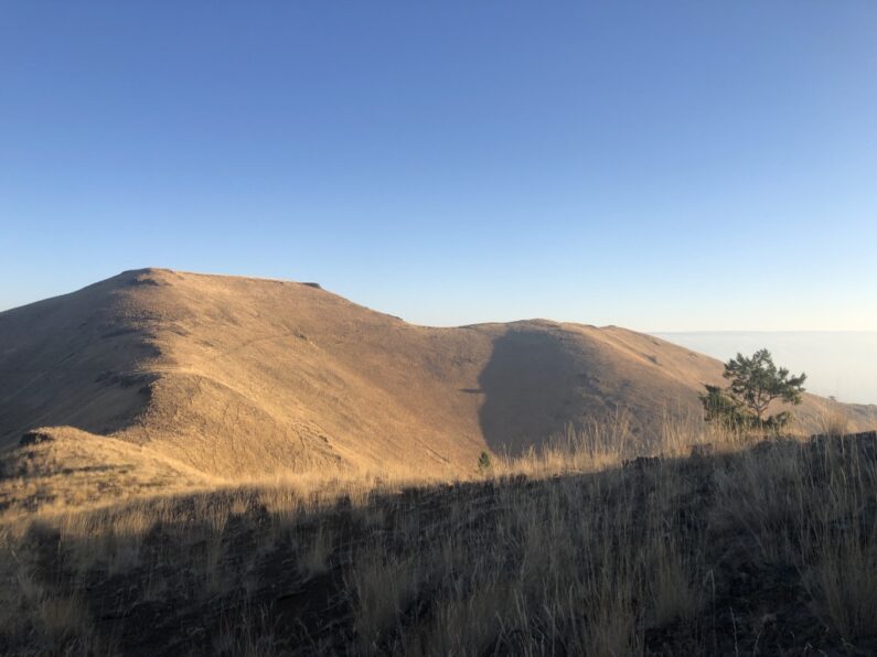
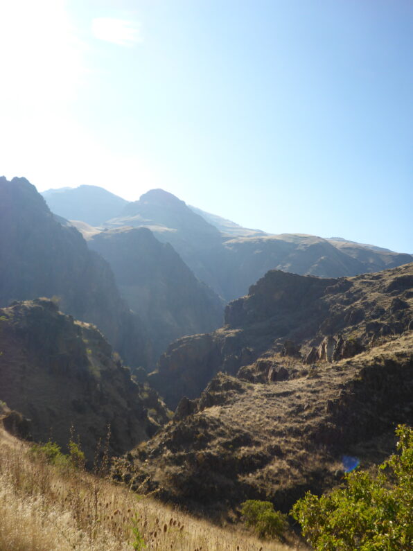
Man, it was spectacular up there a long series of ridges one after another all leading us eventually to our jump off point to descend to the Snake River. We walked for miles enjoying the traverse and the scenery, this is my favorite kind of hiking high above the world on a remote ridge, with endless views and small trail scene far off leading the way. We took a detour onto a side trail because we spotted a water trough high on the ridge, we inspected it and marked it down for future hikers to use, then I decided to bushwhack up and over the other side of the ridge to the correct trail, it was rocky and steep, but it was at least forward progress.
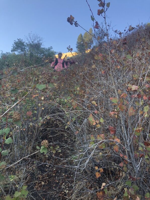
We kept on the ridge until we found a few cairns that led the way, here in the middle of nowhere was series of trail markers, however, they quickly ended, and we realized we needed to be down in the drainage which was the start of Dug Creek. We carefully descended down the steep slope of grass and loose dirt, and then entered right at the top of the drainage. A few hundred yards in and I now know why they call this place Hells Canyon. For the next few hours, we pushed our way through the brush constantly. Luckily every plant we pushed our way through, or under was covered with some type of thorn, mostly it was a mix of wild roses, hawthorns, thistle, blackberries, and just to make it more fun anywhere there was a bit of water still left from the summer droughts, we got to deal with endless amounts of poison ivy, which I am terribly allergic to. Even with the knee-high gaiters my legs we slashed and bleeding, and at times it seemed like we couldn’t move the brush was so thick. Just like in a snap of the fingers we went from my favorite type of hiking to my least favorite, well maybe not really the least favorite that would be rain/snow mix for days on end (like the last week on the CDT in 2016)
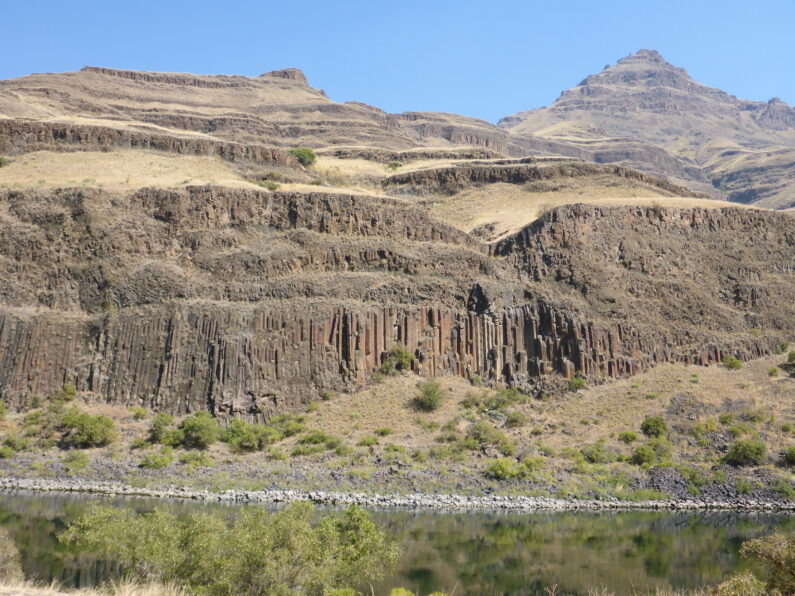
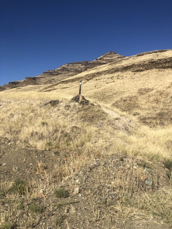
We slowly made our way down the drainage, each step taking us lower and lower towards the Snake River, we finally emerged from the brush and entered a rolling landscape of rocky canyon walls and open meadows of grass and yellow flowers, oh and more poison ivy. We neared a trail junction and found a trail post with some directions to the river. The open grasslands were a nice change, but the sun was now high in the sky and the temp was climbing quickly. We followed along the faint trail we had to be careful to watch for all the poison ivy growing along the edge, finally, we crested a ridge and saw the ranch and the famous Dug Bar down below.
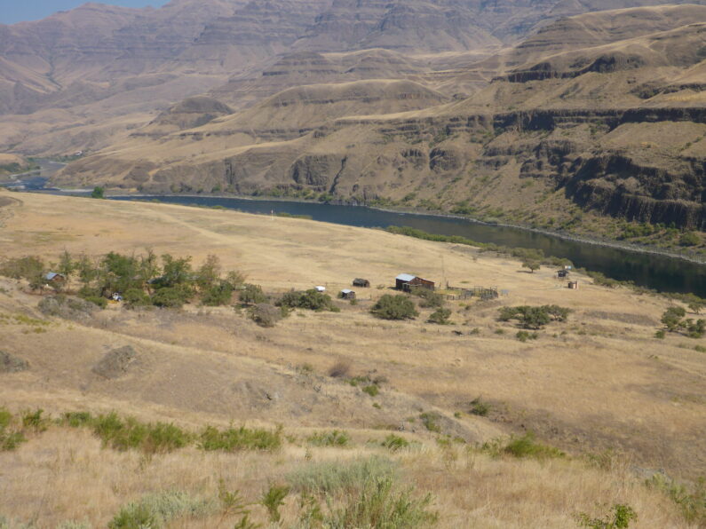
We arrived at Dug Bar and walked through the old, abandoned ranch and spotted the boat launch and interpretive signs by the river. We flopped down in the shade of a sign as it was way over 87 degrees out and the shade was great relief until we looked up and started counting the numerous black widow spider that live in its rafters. We decided it was best to go to river and wash up and try to get off any poison ivy oil on us, and some of the caked-on dirt and sweat form the past few days. The Punisher came down to oak her foot for the past few days her big toe has been swollen and getting red, not sure if it was toenail getting ready to fall off or worse an infection of sorts. As we washed up a few jet boats came up and down the river, the happy boaters waved to us and sort of looked at us like we were animals at the zoo.
We walked back up to the shade, filtered water and ate, filling our bodies with salty snacks and liter after liter of water. While we were there two dirt bikes came down the road and stopped at Dug Bar. The two riders waved hello and came over to chat with us. One of the riders turned out to be the Wallowa County Sheriff out on a ride/patrol. We told the sheriff about our hike and what we were doing, he told us his favorite part of his job was doing Search and Rescue, he proceeded to tell us this 3 times while looking us over thing to himself, “I’m sure I’ll be out looking for the 3 of you in the next few days”
When we mentioned we hoped to get to Buckhorn Overlook today, he said this, “That’s a really steep climb up from the river, if it was me, I would go to Cow Creek Bridge, and camp there tonight then climb in the morning. The bridge has some nice trees and good places to camp, it’s a quite road and you’ll be happy you stopped there.” With that sage advice he and his buddy rode off in their Endura bikes leaving us in the tranquility of the river.
We started up the road and instantly came to a trail maker for the Nez Perce Trail, we looked at the maps and between the heat, and being wiped form the first half of the day, opted to rad walk to Cow Creek Bridge instead of taking the faint trail up and over two more mountains. We walked for hours it was hot and the sun was blazing, I hid under my umbrella as much as possible and as the sun hit all the scratches and scrapes, they started to burn, it was brutal.
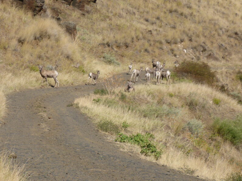
We came around a corner on the road, which had turned into an endless climb, and we were treated to a herd of about 25 bighorn sheep. They were laying in the road, and munching on grass, as we got closer, they ran up the hill when we walked by where they had been laying we saw a water trough full of water they had using. I should do have known better and grabbed a quart of water while there, about an hour and a half later, I cursed myself as my water ran out and we still had miles to make.
It felt like the day would never end, we finally spotted some shade and there were a few puddles of water in the road from a small seep, we sat down for a snack and carefully dipped and drank the little bit of water to be had there, it was past 4:30 and we had been hiking for close to 12 hours, and we were still 8-10 miles from Ron, who was waiting for us at Buckhorn Overlook to resupply us.
The 3 of us discussed our options, we were all bushed and opted to call the day early and only hike another 2 miles to Cow Creek Bridge over the Imnaha River and take the sheriff advice of camping there.
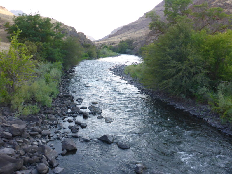
The sheriff was spot on, we arrived at a lovely campsite among the trees next to the river. The serene sound of the river was soothing after a long day and we had time to go soak our feet in the water, have a leisurely dinner and get well hydrated after the long hot day. I decided to cowboy camp for the night under a locust tree, the stars stared to come out right as drifted off into a deep off to sleep wondering what type of fun the climb back out of Hells Canyon would be the next day.