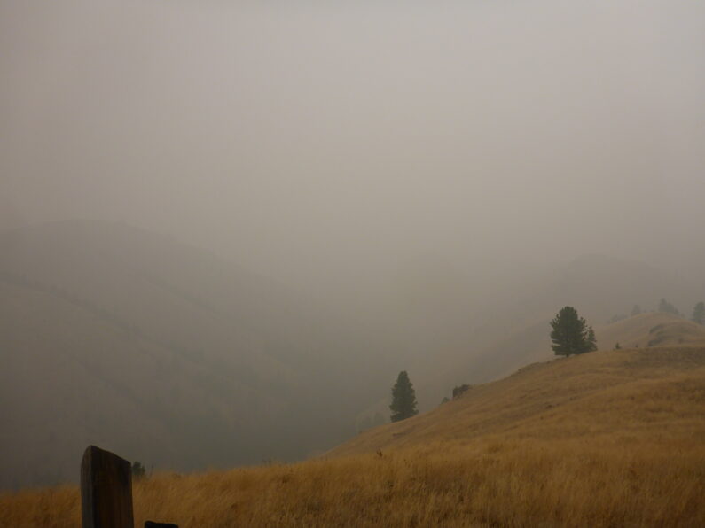
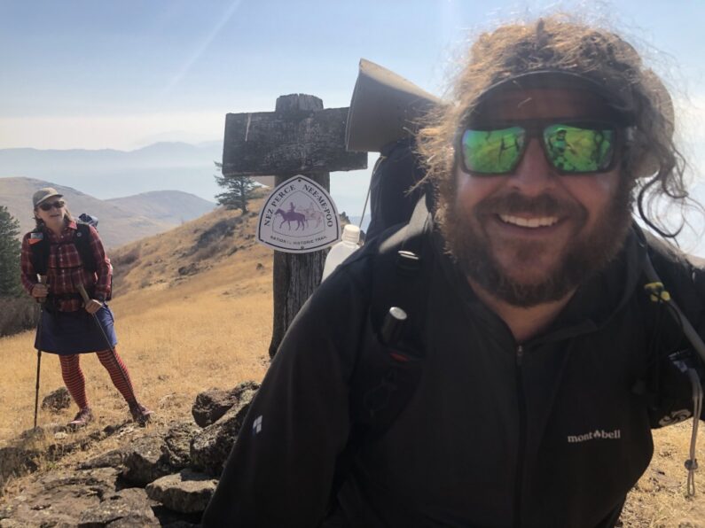
BMT Day 13, A Road Walk Reprieve to Troy
Indian viewpoint to Troy via main road 21.25 miles, Elevation Gain 860’, Elevation Loss 3,474’
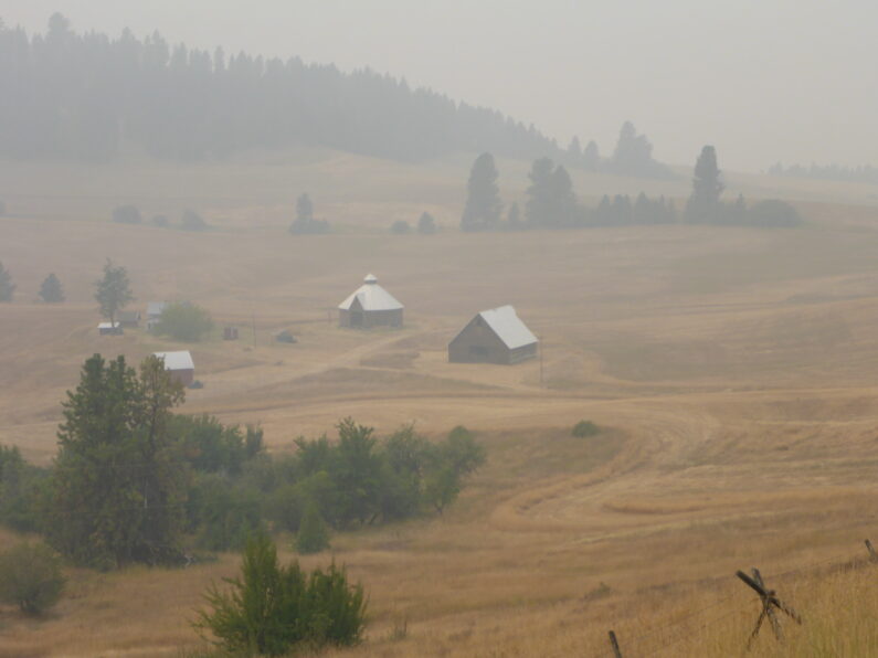
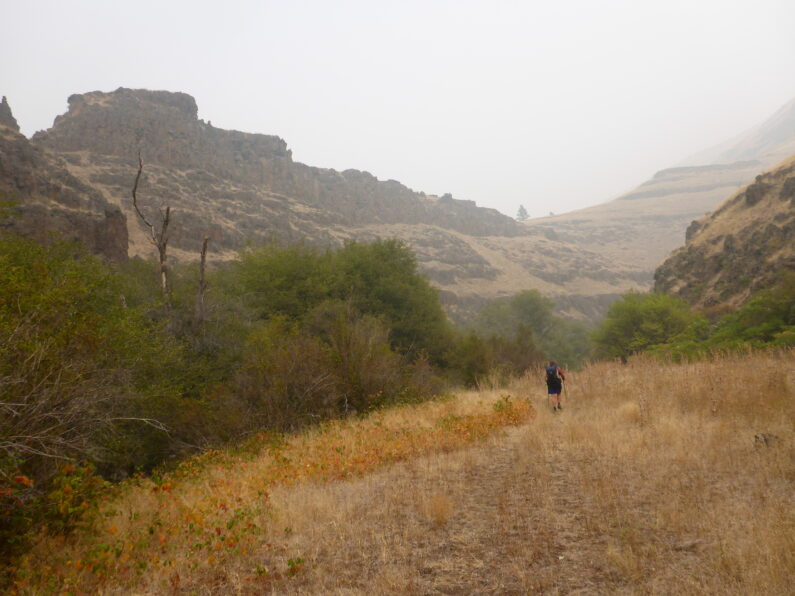
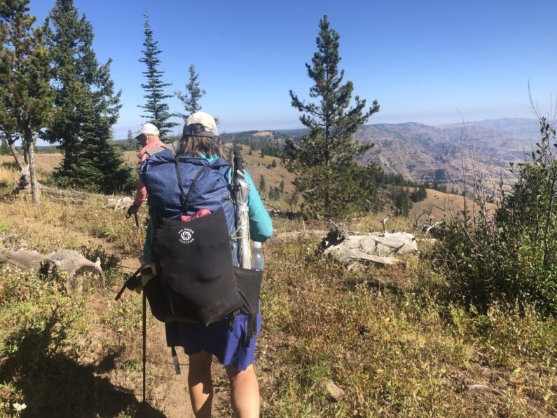
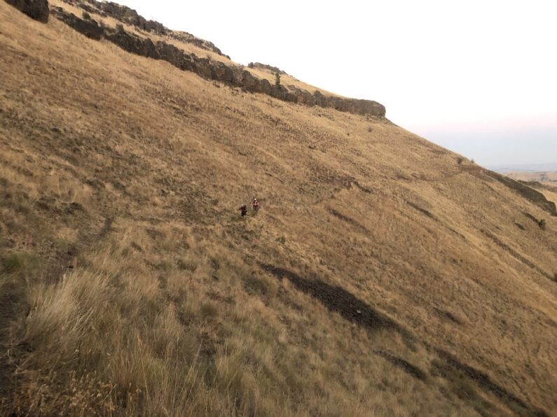
We woke up and knocked out the morning routine of coffee, breakfast, and packing up. In the twilight of dawn, we said goodbye to Ron as he was heading home, and the three of us started on our road walk to Troy. We had a little over 20+ miles to get to town by 2 pm to meet Mike and Donna for our resupply and little visiting.

We headed out on the road which was gravel and then at times paved but being morning, it was cool and an enjoyable reprieve from days of bushwhacking. Along the way, we passed old ranch homes, a pioneer church, and wound our way along a series of roads, and even crossed a secondary highway. The road walk was pretty uneventful except for one spot, as we got close to Troy our route showed us using a USFS road that cut off from the main road to Troy and would drop us down the canyon to the Grande Ronde River. When we started up the road, we saw a private property sign, weird but there was no gate and it was clearly marked public on our maps. About ¾ of a mile up the road, we came to a house and the owners had made it clear the road was being restricted to public use. Wanting to avoid any conflict we opted to backtrack and just walk the main road to Troy.
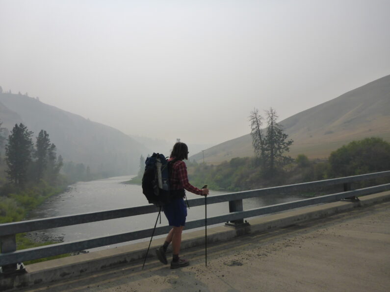
FeMike kept us on pace and made sure we pumped out a steady 3mph, not wanting to be late for Mike and Donna we only took one short break and made sure to grind out the miles hour after hour. The walk went smooth along the way, we saw mule deer, some homes, and then a few miles before the Grande Ronde the road took a turn, and we could see it switchbacking down to the river.
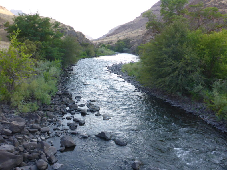
We dropped down in elevation quickly and then found ourselves along the Grande Ronde River. We walked along the road and crossed a bridge over the river and hung a left to Troy. The temperature was pleasant enough and as we approached the town, we knew the store was closed but we had dreams of a soda machine or possibly even a shower. When we arrived in town we had beaten Mike and Donna, so we dropped out packs in front of the store and took a look around. The Soda Machine beckoned us to try it, but there was no power and no option for a drink.
As we sat waiting for Mike and Donna an SUV pulled up and went into the building across the street which was the local laundromat and showers. I went over and explored it, there was a nice lounge and power outlets, so I plugged in my battery pack to top off, and went back outside.
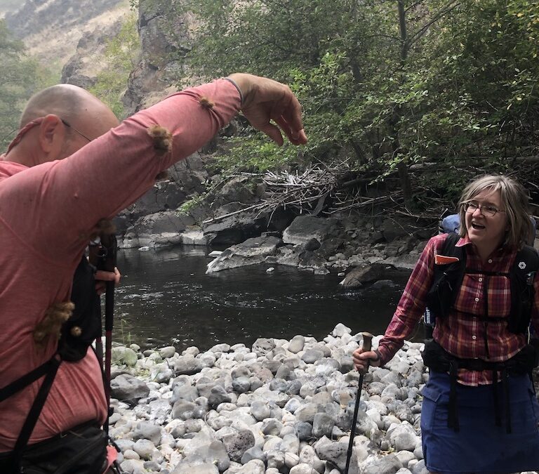
Mike and Donna arrived and brought us treats, chips, cold beer, cold soda, and some amazing homemade oatmeal bars with chocolate. We spent a few hours visiting with them, and I walked over into the RV park to see if anyone could tell us if we could camp there or maybe pay for a shower. I met a nice guy, he told me the owner was away for a few days, so basically, we struck out.
Mike and Donna had a few hours to drive home so after visiting they agreed to give us a ride a ½ mile back to the ODFW campground along the Grande Ronde we had passed on our way into town. Before we left a guy pulled up and started chatting us up, he was bow hunter who had been walking the area for decades, he told us the Wenaha River had a good trail and we should have no issues getting to Tollgate, hooray!
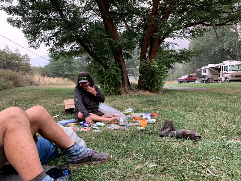
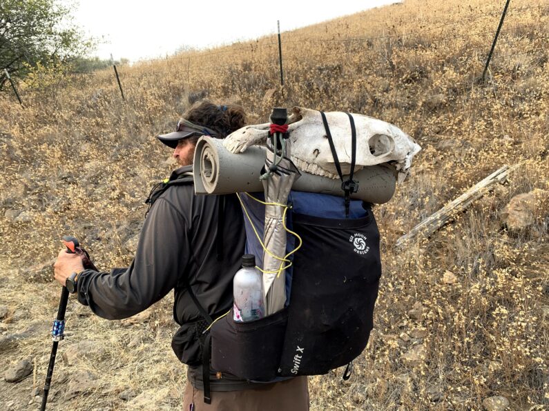
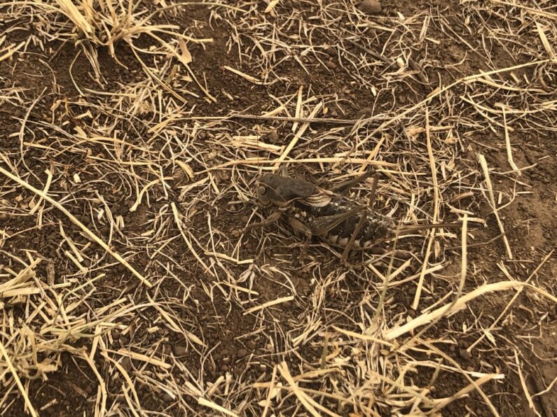
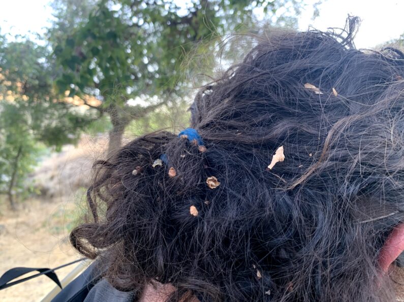
The campground was a nice spot along the river with soft grass to sleep on, a pit toilet, and access to the river. There was a large RV parked across the way with a family and a few dogs. In true hiker fashion, I had a full-on yard sale going on with enough food for a group to live off for a week spread all around me. I was doing all I could to eat the food and sort out what to take with me. The young girl from the camp came over and started to talk to us, she said the funniest thing to me, “My dog Alpine likes to steal food and you can’t blame him if there is food lying around, and sir you have a lot of food lying around.” At that The Punisher fell over in laughter at the absurdity of the food spread I had and the young human’s observation.
The young girl’s father eventually came by and we told him about our hike, he said, “You know there was a fire in that river canyon a few years back and it burned up about 6 or so miles of the canyon?”
We had no idea, but we figured that there could be some damage, but it wouldn’t be too bad, because if it was surely we would have heard about it from the other hunter we had talked to. We spent the rest of the evening lounging before turning in for an early night and much-needed deep sleep before our next leg of the trip.
BMT Day 12, This is going to hurt
Bivy above Tamarack Creek to Indian Viewpoint of Joseph canyon 9.5 mile
Hiking time 12 hours of hiking
From my on the trail notes-Hardest day of hiking ever
The three of us awoke before the sun was up but given our sloped and precarious camp, I don’t think any of us slept too well. I clearly remember at one point in the night rolling over with a pain in my back, only to reach underneath my pad and extract a softball size rock that I had been sleeping on. The three of us tried to make light of our situation but cracking jokes about bear scat, and how the only trail marker around were all the piles of scat. We all were really trying to avoid the very real possibility that we were going to have to backtrack the way we came and then figure out some alternative around the canyon, a daunting task to say the least.
Once the sky had turned to a pale shade of smoke, FeMike and I headed out to try to scout a way into the main part of Joseph Canyon. It was only 3/10 of a mile as the crow flies and we could see the canyon wall in the distance. Given what we went through last night though that canyon wall might as well have been the Canadian border and we were standing on the Mexican border looking north on the CDT. The Punisher stayed behind to guard our gear incase a bear decided to come for a visit, luckily, she was armed with a whistle and some UL titanium cookware to scare it off.
FeMike and I slowly walked along the narrow rim we were on, slowly picking our way and looking below to see if there was any path below us. Each time we looked down all we saw was steep rocky terrain covered in thick vegetation. Going low was not an option and staying high had its own challenges of really unstable footing and a big fall if you made the wrong move. Over the next 45 minutes or so we worked our way along the edge until we came to the end and could see Joseph Creek down below. It wasn’t going to be easy, but we had no other choice but to give it a go. We slowly worked our way back to camp, then in one small draw, I lost my footing and went crashing backward landing in a pile of dry locust branches. FeMike came to help me up and when we finally extracted me, we saw a gaping hole in my down jacket…bye, bye feathers.
Eventually, we made it back to camp and told The Punisher we thought we had a way through, it wouldn’t be easy, but it was better than trying to drop down into Tamarack Creek or backtrack. We sent Ron a message on the inReach letting him know we were starting out and he didn’t need to wait for us as we thought it was going to take us some time to get through the canyon. I got a confirmation the message went through, so we strapped on our packs, gave a quick glance around to make sure we hadn’t left anything behind, and hit the, err trail?
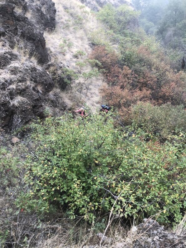
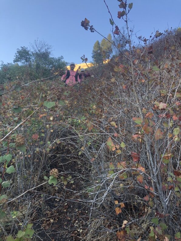
The three of us walked carefully around the rock walls and sloped ground that made up this canyon wall. We took our time being careful where we stepped as a twisted ankle this deep in the boonies would be a disaster in itself. The going was slow, at some point I got ahead of everyone and worked my way around a very steep and sketchy area, I waited and then saw that FeMike and The Punisher had decided to avoid that area and drop below it and walk through some of the higher vegetation. I could see them from above, but it was so thick in there they couldn’t see each other. I called out some directions from above and a few minutes later they popped out and climbed back up to me. We kept walking along and eventually came to the point where we thought it would be the best way to dropdown. The steep terrain was brutal we all kept slipping and sliding as the grass and gravelly terrain was the equivalent of walking downhill on greased marbles. About 300’ from the creek we were smacked dab in the bushes again. This time it was blackberries poison ivy and tons of hitchhikers. We barreled our way through and then each dropped into the strong current of Joseph Creek. From where we entered, we could see an open area on the opposite shore and a few trees. We made a beeline to that spot to regroup.
When we climbed onto the shores, we entered a land before time so to speak, there were giant pine trees, high dry grass of the late summer, and endless piles of bear scat, I mean seriously how can bears crap this much in one area? The amount of scat was overwhelming it looked like a clan of bears had been having a 3-day musical festival on the shore, just gorging themselves on berries then crapping all over the place. We filtered some water, sat down, and pulled out some snacks. It had taken us an hour and a half to go a full 3/10 of a mile. I had no idea that a human could move at such a slow speed while exerting that much energy. As we munched away, we consulted our maps which showed a Pack Stock Trail on the side of the creek from time to time switching sides.
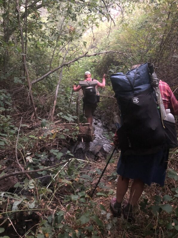
We found what we thought was the trail and started along it, in a few hundred feet in and we were in fields of poison ivy, red in fall colors. The trail petered out and it became apparent from the numerous braided trails we were actually standing on a series of game trails that went up and down the canyon. We tried to push through the high brush, but just like the night before every step slapped you with some sort of thorn scraping upon your shins. After a few times trying to get through, looking for the trail, or just trying to find a path that might go through, we said screw it and dropped into Joseph Creek. The path of least resistance was going to be wading upstream along the slippery bottom.
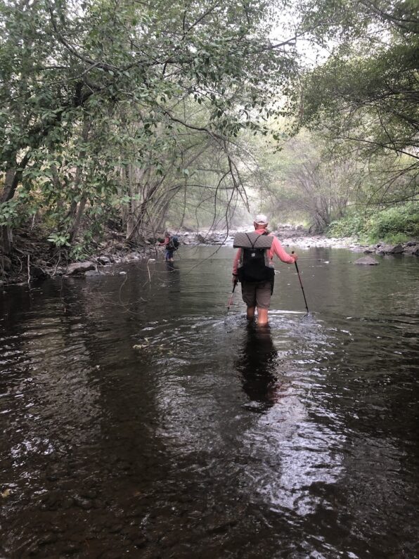
For the next few hours, we waded slowly upstream, no way to rush the miles when you have to pick up your foot against the current and slide it to the next spot ensuring your footing before picking up the next foot. Each time it got to be too deep or too much work, we would try again to go on the banks or work our way through the woods. We walked along gravel bars, we meandered through the open grasses among the pine trees. At times we would find an old trail and follow it up, then when the brush once again became too thick, too much poison ivy, or just too much work, we would drop back down into the creek. The entire time this was going on we would get a sporadic message on the inReach from Ron who was concerned that it was taking us so long, we would send an update and tell him to get on the road back to Portland and not to wait as it was going to be all day. Later that day we would learn that between his inReach and ours’ the messages we sent were not getting to him when sent, but instead would drop in a batch hours later.
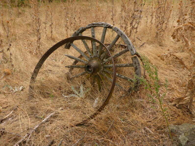
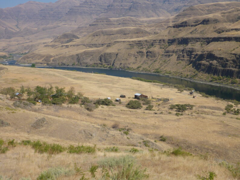
Finally, after hours of trudging along through the canyon, we came out of the river up onto a bank for some hopefully dry hiking and stumbled across an old wagon road. The craziest thing was there were freshly sawn blowdowns and tire tracks from a side-by-side ATV, hallelujah maybe we are finally out of this hell! For the next few miles, we followed this path, it took us by a series of old homesteads in the canyon bottom, we passed by old wagon wheels and broken-down cabins, boy oh boy the people who worked this land must have been made of some serious meddle.
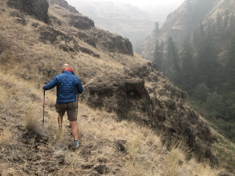
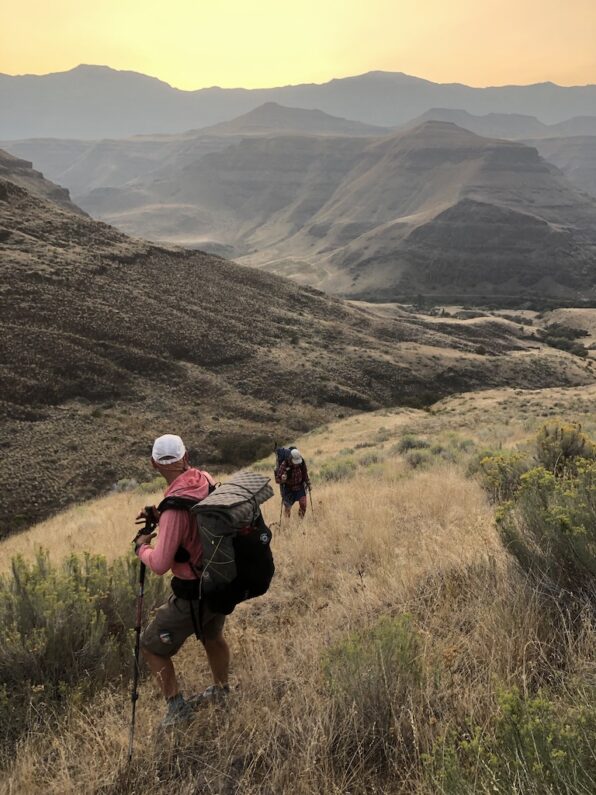
Finally, the path opened up into a wide grassy meadow with large willows on the side of the river. We began looking for the path up, our maps and data showed we were to climb steeply for a couple of miles along a path to Indian Viewpoint. We scouted around and around and just couldn’t seem to locate the spot, then as we were losing faith a jeep road appeared. We started up it and to our surprise, our tracks matched, woo-hoo!!! The tree of us started up the steep road steadily climbing up higher and higher into the smoke-filled sky. The road seemed never-ending and we wondered how anyone could have gotten a wagon down it in the past.
We steadily climbed higher and higher on the road, about an hour in we looked at our GPS and noticed that we were again off-trail. The routes showed a line going up the side of the drainage, but we couldn’t see any path, so we figured we should stay the course. On the side of the road, we found some shotgun shells that appeared to have fallen out of someone’s pocket while on the road. Mule deer could be seen running through the trees up above us, and we longed for finally getting back on top of the canyon. We topped out and quickly came to a gate across the road, huh that’s weird, we unlocked the gate passed through, and relocked it as we carried on along the road. As we were walking along what we believed was the road to Indian Viewpoint, we saw a ranch house, a horse trailer with a horse tied up, and a large older cowboy and his dog enjoying a PBR tallboy while taking in the sunset or lack thereof.
The Cowboy looked over and saw us, and frankly, from the look on his face, we might have been Sasquatch or some other mystical creature just suddenly appearing out of nowhere. I dropped my pack and headed over to smooth over what was clearly us trespassing on his land when we made a wrong turn.
Me, “Hi, can I ask you a question I think we are lost?”
Cowboy, “Huh, where did you all come from Indian Viewpoint?”
Me, No we came up from the bottom of the Canyon where the road comes in past the cabin”
Cowboy, “My new cabin down there?”
Me, “No some old busted up one we passed by down there”
The cowboy tipped up his beer, looked at me standing there with twigs in my hair and my kilt blowing in the wind, and asked me again, “Where did you come from?”
Me, “We entered Joseph Canyon yesterday at Tamarack Creek”
When the cowboy heard this, he just started busting out in a large belly laugh while shaking his head in disbelief. Then asked me, “so where are you headed?
Me, “John Day”
At this, his face had a look of astonishment where I am not sure if he thought I hit my head hard in the canyon or was just a truly crazy person, but with that declaration of destination his smile got bigger and his laugh grew louder.
I explained what we were doing and that we had gotten confused down in the canyon on how to get out. I showed him my map on the phone and told him Ron was waiting for us at Indian Viewpoint. The cowboy told me we could go down his road across his property and through the gate to get to the main road and Indian Viewpoint. I thanked him for the kindness, and he said did, “hey did you shut my gate back there”
I replied, “Yes sir we sure did, my rule is however I find a gate is how I leave it. If it’s open, I leave it open, if it’s closed, I close it up once I am through.”
The cowboy took a slug of his tallboy and said, “good you know cowboy code, be safe out there, and don’t go on the neighbor’s property they are not friendly”
We loaded up our packs and headed down the ranch road, jumped the gate, and hit the main road to Indian Viewpoint. It was maybe an hour before dark and we slowly walked up to where we should have exited the canyon. Ron’s van appeared and we shouted in relief. Ron was there it was late, and he hadn’t left. He told us he had just gotten off the phone with his friend Ken discussing at what point he should call the sheriff because we hadn’t arrived. Man, that Sherriff would have been in heaven and probably told us. “I knew I was going to have to rescue you all when I saw you at Dug Bar.”
We told Ron all about our struggles of the day, he gave us soap to wash up and try to get the poison ivy oils off our legs. We made some dinner and started to chow down. About 20 minutes later we hear a quad coming up and our buddy the cowboy arrives. He told us he wanted to make sure we were OK and had made it to our buddy, maybe he was still in shock at the sight of us and just wanted to make sure he hadn’t imagined our existence. We talked for a few minutes between mouthfuls of food. He left us as the sky turned to black, and the three of us rolled out our pads, on the side of the road behind Ron’s van. As we’re starting to drift off the 3 of us kept making jokes and laughing about how all day we had followed the bear scat cairns, and we decided when in doubt we should trust the scat going forward…as the giggles slowly drifted off, the 3 of fell into a deep well-earned slumber.
Field Note to Future Hikers–This section of the Blue Mountain Trail has been re-routed to help avoid this area and the long, strenuous, and at times dangerous day and a half, we had experienced. The new route was successfully hiked by She-Ra the following month when she completed the first solo thru-hike of this trail. However, her way is still difficult and to date, Joseph Canyon is still the crux of the BMT.
BMT Day 11 Joseph Canyon, Welcome to the Machine
Vigne CG to Joseph Canyon 24.14 miles, 2,126’ of Elevation Gain, 3,825’ of Elevation loss
Authors Note- I generally try to tell it like it is on the trail without too much hyperbole or drama, because at the end of the day I have always viewed long-distance hiking a as series of day hikes strung together over a series of weeks or months. With that said days 11 & 12 of the Blue Mountain Trail were some of the hardest hiking and route finding I have ever experienced. The following blog post is long, but if you want to know what it’s like to ground-truth a new route and have everything go to hell in a matter of 100 yards then you’ll enjoy this passage.
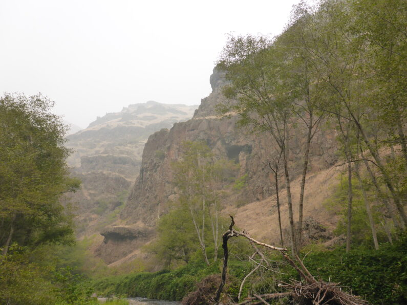
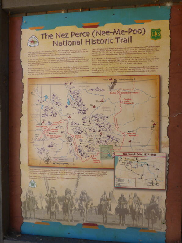
We awoke before dawn and enjoyed a nice big breakfast and coffee before loading up for the next leg of our journey. The anticipation to get to Joseph Canyon was palpable, this canyon is not only the birthplace of Chief Joseph of the Nez Perce but also one of the most historic precious lands of the tribe. The canyon was the home to the Nez Perce for millennium, and it also played a significant role in the Nez Perce War. After reading so much about this canyon prior to the hike I couldn’t wait to make our miles and get into this remote canyon to see it for myself.
We said goodbye to Ron and headed out to the road to continue on our way, the route took us up a gentle dirt road, and then we had a little cross country to an open meadow among the trees. I got a cell signal, so I called home to get the latest update on the fires in the Portland area, from what Suzy relayed to me it was apocalyptic and getting worse by the day. We discussed how bad the air quality was and she warned me it was heading our way. We worked out some details on meeting up with us in La Grande in about a week and then we said goodbye and carried on.
The miles came easy and the 3 of us were making great time laughing and hiking along without a care in the world. At about 11 am we came over a small rise in the road and saw Ron parked on the side of the road, so we pulled up for a quick lunch and to top off our drinks and water. As we sat there along the road munching away, a giant wall of smoke started working its way towards us, in a matter of minutes our sky turned from a light haze to a dark gray and we could feel the smoke in the back of our throats. Well, I guess it was inevitable when the entire region is on fire there is no escaping the smoke, luckily, we were in the only part of the PNW without any fires so we counted our blessings and figured we would just have to make do.
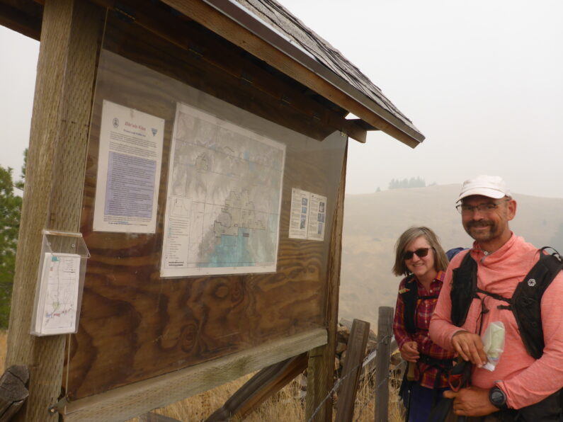
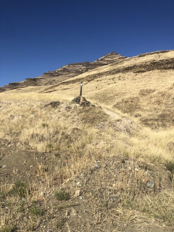
After our leisurely break we loaded up and carried on towards the infamous Joseph Canyon, Ron again said he wasn’t leaving the area tomorrow until he knew we were out of the canyon, we told him it was necessary, but he insisted. We continued winding along some USFS roads climbing up towards the canyon rim, however with the smoke, we could have been anywhere since the views were nonexistent. We finally came upon the entrance to Joseph Canyon. There was a barb wire fence and gate going over the road that would drop us down along Tamarack Creek, by Tamarack Cow Camp, and into Joseph Canyon. There was an information board and some paper maps showing the road down to the trail along the canyon, and the trail back up to Indian Viewpoint at the end of the canyon where we would exit.
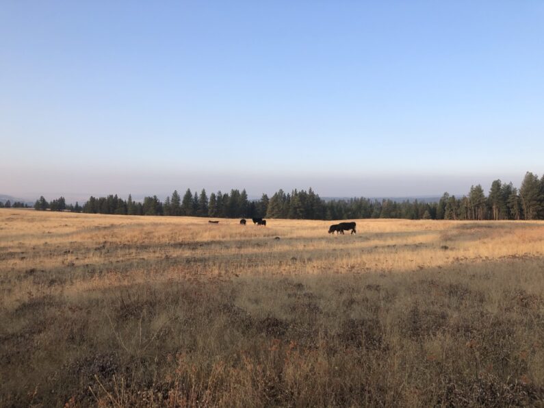
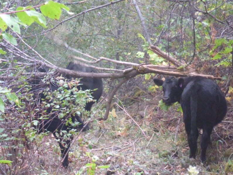
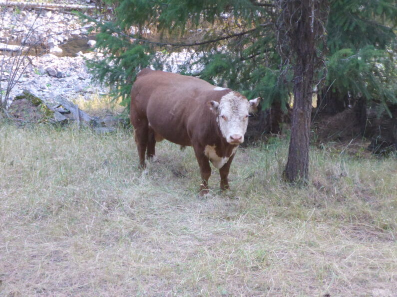
The road walk down along Tamarack Creek was lovely, it was a well-maintained road and graded nicely, with each step we lost more elevation as we walked back in time. About a ½ mile before Tamarack Cow Camp we ran into a small group of cows made up of mostly heifers and yearling calves. Like all cows instead of running off to the side, they insisted on running in front of us pooping all over and mooing. A little way down the road they would pause and calm down, then see us again and trot further down the road, no matter what we did couldn’t get these cows to leave us be and get out of our way.
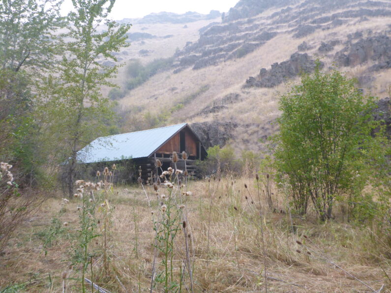
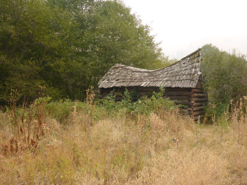
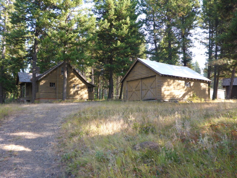
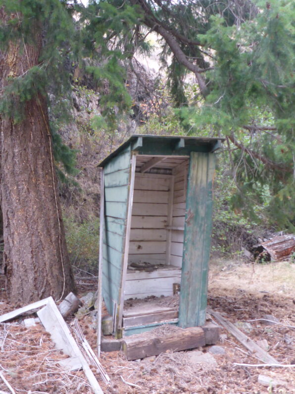
As the road finally flattened out, we came to a series of old cabins and an old barn comprising of the camp, the privy was a little bit rough for use, luckily none of us needed it. The day was getting long now but we figured we should try to get in as many miles as we could because canyons generally tend to be slow miles especially if the trails aren’t in good shape. Right at the end of the camp, the road ended, and the trail disappeared. We saw a faint trail down below the cabins that hugged the small Tamarack Creek, we dropped down to hike it and right on cue, the cows dropped down in front of us. I hate pushing someone’s cows it stresses them out, makes them lose weight and it’s just as unpleasant walking in their piles of cow pies as it is for us to feel bad about pushing them.
The trail at this point went all to hell and pretty much disappeared, one benefit was the cows were doing a good job of pushing the endless blackberries and other thorny plants out of our way somewhat. We scrambled along climbing under sharp bushes and trying to figure out the path of least resistance to travel forward. All of sudden as we were pushing through some bushes, we heard the cows going crazy. They were balking and making a racket, we stepped off into the bushes and into the creek just in time to see the cows turn 180 and go rushing by us in a fright…” What the actual hell was that about?”
I stepped back onto the “trail” and walked a few feet forward and was greeted to the equivalent of being cliffed out, in front of us was a 12’ + tall wall of the thickest most solid blackberries you have ever seen. Apparently, they were so thick even the cows couldn’t get through. We looked at each other said a few curse words and knew that our pleasant walk was over. We also took stock that we were losing daylight and were in no position to camp where we were.
We dropped down to the creek and tried to walk up the other side, but the terrain was slick with moss and lose rocks and more blackberries. After trying that we gave up and dropped back into the stream. We tried pushing our way through the thick brush, but each step got us tangled in blackberries that cut us open and slowed us to a crawl. At one point I pulled out the 3” blade of my Gerber knife and tried to use it as a machete to cut away some of the blackberries to move forward. Finally, we made it through and came up against a rock wall with water trickling down in a small waterfall. We gathered together and asked ourselves, “what the hell are we going to do?”
The sun was long gone, and darkness was taking over. I looked at the rock wall and saw a way I could pick my way up. Being igneous rocks, it tends to be crumbly and hard to climb, but we really had no other choice. So, with that, I channeled my inner Stallone from Cliff Hanger and slowly picked my way up to see if I could get a good vantage point or somewhere to call camp. I pulled myself up over the last little lip of the wall and came upon a sloped small outcropping just big enough for the 3 of us to sleep on. I called back down to FeMike and The Punisher who were filling our water bags for the night that we could camp up top.
I dropped back down leaving my pack up top so I could help each of them up top. I knew this was little beyond everyone’s comfort zone of safety, but we had no choice. I helped The Punisher up first and got her set up top before dropping back down to help up FeMike. After a few minutes of pulling and struggling the two of us joined The Punisher. I turned to her and asked, “Will this work for camp tonight?” the ground was pretty sloped and close to the edge.
The Punisher turned to me and said, “Sure just let me get all the bear scat out of the way first”.
The ground was covered in piles of bear scat. Literally, every place you looked and shown a headlamp on was a pile of scat, oh well a bear has never attacked a group of 3, right? Well, that’s at least the theory most hikers use to keep themselves calm.
We did our best to find flattish places to sleep, the 3 of us decided the only choice was to cowboy camp as there was no way to set up a camp, I guess we were really embracing the definition of a bivouac. We sent out our location to Ron and Suzy letting them know that things had gone to hell in a handbasket in the last few miles and we weren’t sure until daylight if we could go forward or have to backtrack all the way to the rim where we first came down Tamarack Road.
The moon rose in the sky with a blood orange color from the smoke and we looked down into the dark canyon below as we cooked our dinner and discussed our plan for the next day. In all of our years and combined miles of long-distance hiking, none of us had ever seen anything like the bushwhack we were no in. We decided the best plan of attack was to sleep until it was light enough to see then at first light FeMike and I would go scout ahead without our packs to see if we could make it the last 2/3 of a mile to Joseph Canyon where our maps showed a pack trail, and we were told the going would be easier.
As I tried to fall asleep, I kept feeling like I could roll off the edge at any minute and the pit in my stomach gnawed at me with endless dreed of what the next day might have in store for us. Luckily, I was so worn out that no matter how much my mind raced I quickly fell asleep.
BMT Day 10 Sometimes the Miles Come Easy
Buckhorn overlook to Vigne Camp 18.2 miles, 699’ of Elevation Gain, 2,077’ of Elevation Loss

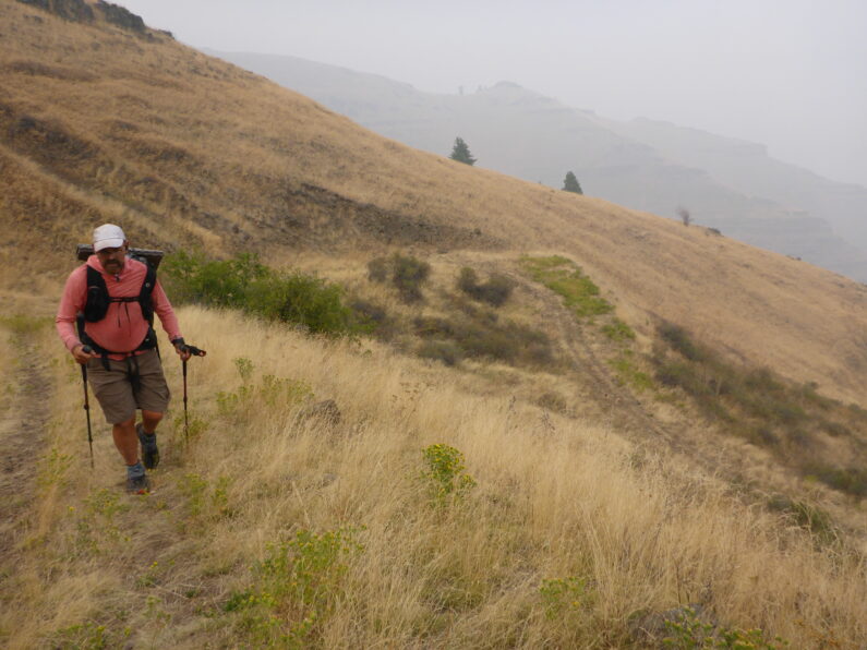
Leaving town is always hard, especially when you know the smoke conditions are only going to get worse. The 4 of us took our time in Enterprise, we had a nice big breakfast and hit the local Subway for a lunchtime foot long, pro-tip the best sandwich to hike out of town with is the Italian BMT as it holds up well in a pack. Around 9:30 am we all loaded back up in the Van and bounced along the road back up to Buckhorn Overlook. An hour and a half later and Ron said goodbye as headed down the road to where we would camp that night. Ron had spent some time mapping out a route for us that avoided the original route which would have taken us along a busy gravel road with little shade. The new route used a series of smaller gravel roads that wound through the forest upon the rim.
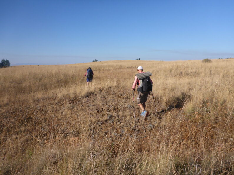
Even with a late start, we weren’t concerned about making our miles, we had stored most of our gear in Ron’s van and were traveling light with just our essentials, and given the easy terrain and road walking, we knew we could make some good time. The road walking was lovely we saw a few cars but a few of the roads had been decommissioned and were more trail-like than road like. We walked casually chatting and playing the mileage game of how fast we could make the next mile, coach FeMike kept us on the pace all day long.
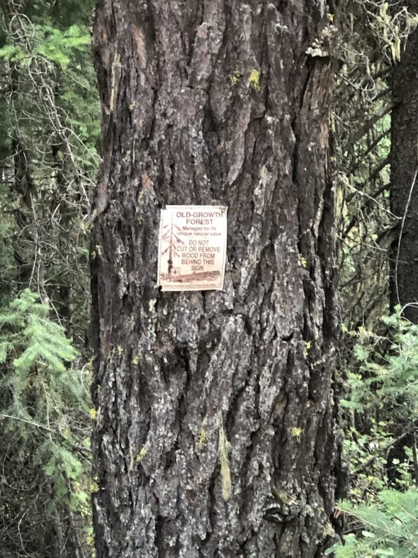
We took a short lunch break around 2 pm and sat in the shade munching our sandwiches and chips. A few cows looked on at us as we walked by, those large bovines were a bit shocked to see us out there. I did notice that the forest had signs stating, “Wildlife Tree” and “Old Growth Forest Beyond this Mark”. It was great to be walking in a forest and get to see some of the old-growth in the area. As we were into the last 5 miles to camp, we came around a turn and saw Ron on the side of the road.
We stopped and snacked on some veggies from the fridge, drank a few cold Gatorades, and chatted about the day. While we were there FeMike dozed off for a quick cat nap, can’t blame him a quick nap is one of my favorite luxuries when hiking. We decided to knock out the last stretch and meet Ron at camp. We rolled into Vigne Campground right before dusk, not too worn out and in good spirits.
Ron had camp all set up with a large flat area on soft grass for us to sleep, a table and chairs ready to lounge in and he whipped up a great eggplant parm dinner and garlic bread for us all to enjoy. As we sat around sipping beers the 3 of us sat down to the tedious task of sorting our final boxes and food bags for the next leg to Troy. The plan was to head out and let Ron get back to town, he said he was going to hang in the area until early Sunday to make sure we made it through Joseph Canyon before taking, but because of the terrain and lack of roads we probably wouldn’t see him again. Besides loading up our packs with 3 days of food, we also had to make sure our resupply boxes for Tollgate were in order. The plan was for Ron to drop these for us at the Tollgate Inn Store on his way home, a bit out of his way, but hey he loves to drive.
After the chores were down the 3 of us crawled into our quilts for the night, I once again decided to cowboy camp out under the stars, but due to the smokey haze, I only saw a few of the brightest stars as I drifted off to sleep.
BMT Day 9, Following the Nez Perce Trail
Cow Creek Bridge to Buckhorn Overlook 6.85 miles, Elevation Gain 4,154’, Elevation Loss 184’
We awoke early once again drinking coffee and packing up well before sunrise. I felt great though the early stop and taking time to rehydrate really made a huge difference last night. The three of us were ready to hit the trail, and we talked about the dread of how hard it may be to climb back up the canyon, expecting another day of nothing but thick thorny bushwhacking and lost or non-existing trail. The Road walk along the Imnaha River was a pleasant start to the day, it gave our bodies time to warm up and the tight muscles to relax and get into the daily rhythm of walking. Being a little more than a week on the trail I finally felt like I was back in my thru-hiking rhythm and my body was feeling good and strong as my trail legs were back.
The road walk came to an abrupt end when we hit the turnoff, right there at the road junction was another Nez Perce Trail marker, the constant reminder of the sad trail we were retracing. When I read about the Nez Perce War, I always thought to myself, “why did they only cover 6 or 8 miles a day?” after a few days in Hells Canyon, I am now amazed that a large group made up mostly of woman, children, and elders could have actually covered such a distance in this rough territory. We consulted our maps and GPS, while there was a trail marker here and a faint trail going up the drainage. Our maps showed that we should head straight up and bear right up the very steep grassy knoll inf front of us for about 1,000’ of elevation. So, with that knowledge, we picked out a point on the horizon and started up the drainage and straight uphill.
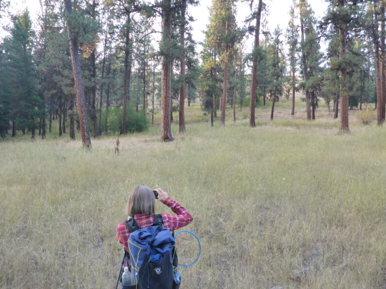
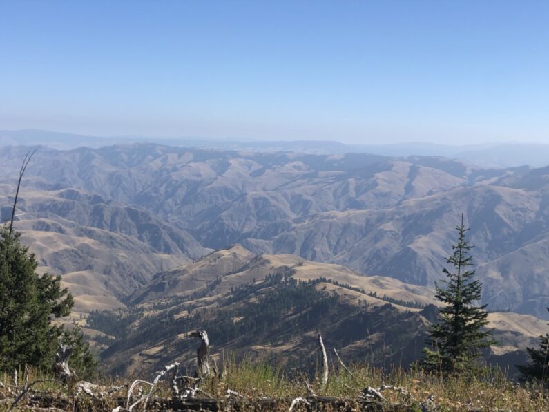
I was out front and scrambling at times using my hands on the steep terrain, it was steep so much in fact that when I looked down at FeMike and The Punisher they looked like they were climbing a ladder more than a knoll. I stopped for a drink and looked back across the Imnaha, to my surprise smoke from the fires in Portland had settled in and we couldn’t even see the other side of the Hells Canyon as it was lost in a haze. FeMike caught up to me and we climbed the last part side by side, when I crested a small rock face to my surprise there was a series of metal pickets with Nez Perce Trail markers on them, and an actual trail…I looked down the other side of the knoll we had climbed and saw a trail that came up all the way from below, well that would have been easier was all we could think to ourselves. The Punisher Joined us and the three of us now followed the trail higher and higher until it dropped us into a large expanse of grasslands in rolling terrain. As we walked along the well-marked trail we marveled at the steep canyon walls in front of us wondering how which way our path to the top would be.
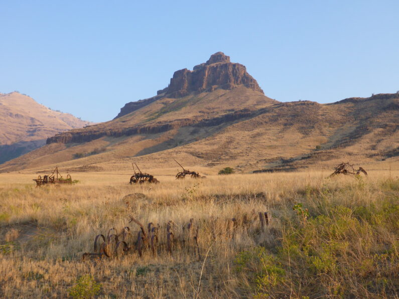
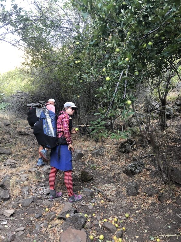
We walked along the top towards an old ranch, along the way we saw rusted old farming equipment once used to cultivate this barren landscape. The trail led us around the old ranch house and up a trail along a small stream. This was a well-maintained trail and we continued to see trail markers as we climbed higher and higher through the shade of trees. The trail was littered with bear scat, everywhere you looked there would be a pile. All of a sudden, we saw an apple tree loaded down with fresh ripe apples, well I guess we know what the bears have been eating. We stopped at the tree and ate a few apples and threw a few in our packs for the climb.
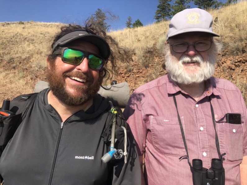
As we climbed higher, we eventually left the forest and bushwhacked straight uphill to an old roadbed that was hugging terrain just below the rim. As we walked along the road towards Buckhorn Overlook, I spotted our trusty van supporter Ron walking down towards us. He greeted us all with a big grin and some ribbing about what took us so long to get here. We told him of our adventures the day before as we walked the last mile or so up Buckhorn Overlook where he had spent the night. Our plan originally was to grab a resupply for the next leg and make some miles, however, ThePunisher’s toe was getting worse and we all figured before pushing on into unknown terrain we should get it looked at by a medical professional. The nearest urgent care was in Enterprise about an hour away and back where we had started over a week ago.
We loaded up in the van and swung by the Buckhorn Campground to locate the spring there, we met a group of Native Americans there who sowed us where the spring was and asked what we were up to. When we told them about the hike, they smiled and said it was really cool we were out here doing that. After some pleasantries, we loaded up and hit the road. The next hour took us along gravel roads, we bounced along admiring the views of Zumwalt Prairie Reserve, a 330,00-acre high prairie reserve owned by the Nature Conservancy.
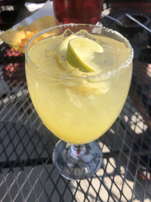
We finally arrived in Enterprise, got a few hotel rooms, and headed over to the Mexican restaurant next door for some lunch. As we sat outside enjoying a margarita and chips, I laughed it was the first time I had been to a restaurant since March, luckily it was a lovely day, and we could sit outside away from anyone. My friends Phantom and Kirstin swung by to say hello, they had been in the Wallowa Wilderness for a backpacking trip, but because of the smoke, they had decided to call it early and headed home. We shared what we each knew about the wildfires in the Portland area and around the state and asked them to check on Suzy for me (they live down the road from us).
After lunch, The Punisher got to see a doctor who said it was most likely just swollen from the pressure of tight-fitting shoes, but just in case she got some anti-biotics to take if the toe got worse. FeMike and I went and did the laundry and enjoyed a few beers next door at the saloon while we waited. The day wrapped up with some quick last-minute shopping at Safeway and a hearty dinner of burgers and fries before we called it a night.
BMT Day 8, Dug Bar and The County Sheriff
Spike Camp to Cow Creek Bridge on the banks of the Imnaha River 19.87miles, 2,943’ of Elevation Gain, 6.516’ of Elevation Loss
What a day, what a F’ed brutally hard day. It started out wonderfully we awoke an hour earlier than usual and quickly broke camp and stared on our way, we walked down the high meadow we had camped in on sloped ground and about 300 yds down from us was a perfect campsite that must be used by ranches. We spoted a small shed below us on the edge of the woods and then bushwhacked straight up hill to our trail to continue on our way.
Man, it was spectacular up there a long series of ridges one after another all leading us eventually to our jump off point to descend to the Snake River. We walked for miles enjoying the traverse and the scenery, this is my favorite kind of hiking high above the world on a remote ridge, with endless views and small trail scene far off leading the way. We took a detour onto a side trail because we spotted a water trough high on the ridge, we inspected it and marked it down for future hikers to use, then I decided to bushwhack up and over the other side of the ridge to the correct trail, it was rocky and steep, but it was at least forward progress.
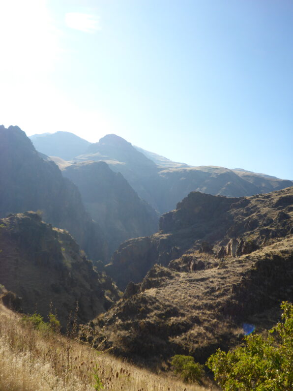
We kept on the ridge until we found a few cairns that led the way, here in the middle of nowhere was series of trail markers, however, they quickly ended, and we realized we needed to be down in the drainage which was the start of Dug Creek. We carefully descended down the steep slope of grass and loose dirt, and then entered right at the top of the drainage. A few hundred yards in and I now know why they call this place Hells Canyon. For the next few hours, we pushed our way through the brush constantly. Luckily every plant we pushed our way through, or under was covered with some type of thorn, mostly it was a mix of wild roses, hawthorns, thistle, blackberries, and just to make it more fun anywhere there was a bit of water still left from the summer droughts, we got to deal with endless amounts of poison ivy, which I am terribly allergic to. Even with the knee-high gaiters my legs we slashed and bleeding, and at times it seemed like we couldn’t move the brush was so thick. Just like in a snap of the fingers we went from my favorite type of hiking to my least favorite, well maybe not really the least favorite that would be rain/snow mix for days on end (like the last week on the CDT in 2016)
We slowly made our way down the drainage, each step taking us lower and lower towards the Snake River, we finally emerged from the brush and entered a rolling landscape of rocky canyon walls and open meadows of grass and yellow flowers, oh and more poison ivy. We neared a trail junction and found a trail post with some directions to the river. The open grasslands were a nice change, but the sun was now high in the sky and the temp was climbing quickly. We followed along the faint trail we had to be careful to watch for all the poison ivy growing along the edge, finally, we crested a ridge and saw the ranch and the famous Dug Bar down below.
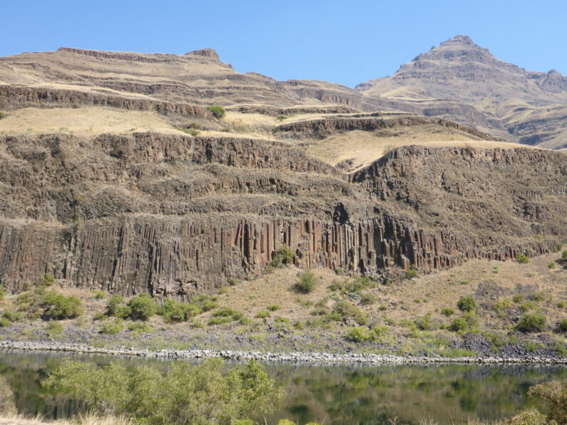
We arrived at Dug Bar and walked through the old, abandoned ranch and spotted the boat launch and interpretive signs by the river. We flopped down in the shade of a sign as it was way over 87 degrees out and the shade was great relief until we looked up and started counting the numerous black widow spider that live in its rafters. We decided it was best to go to river and wash up and try to get off any poison ivy oil on us, and some of the caked-on dirt and sweat form the past few days. The Punisher came down to oak her foot for the past few days her big toe has been swollen and getting red, not sure if it was toenail getting ready to fall off or worse an infection of sorts. As we washed up a few jet boats came up and down the river, the happy boaters waved to us and sort of looked at us like we were animals at the zoo.
We walked back up to the shade, filtered water and ate, filling our bodies with salty snacks and liter after liter of water. While we were there two dirt bikes came down the road and stopped at Dug Bar. The two riders waved hello and came over to chat with us. One of the riders turned out to be the Wallowa County Sheriff out on a ride/patrol. We told the sheriff about our hike and what we were doing, he told us his favorite part of his job was doing Search and Rescue, he proceeded to tell us this 3 times while looking us over thing to himself, “I’m sure I’ll be out looking for the 3 of you in the next few days”
When we mentioned we hoped to get to Buckhorn Overlook today, he said this, “That’s a really steep climb up from the river, if it was me, I would go to Cow Creek Bridge, and camp there tonight then climb in the morning. The bridge has some nice trees and good places to camp, it’s a quite road and you’ll be happy you stopped there.” With that sage advice he and his buddy rode off in their Endura bikes leaving us in the tranquility of the river.
We started up the road and instantly came to a trail maker for the Nez Perce Trail, we looked at the maps and between the heat, and being wiped form the first half of the day, opted to rad walk to Cow Creek Bridge instead of taking the faint trail up and over two more mountains. We walked for hours it was hot and the sun was blazing, I hid under my umbrella as much as possible and as the sun hit all the scratches and scrapes, they started to burn, it was brutal.
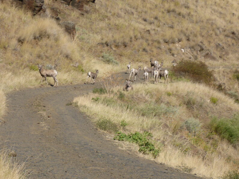
We came around a corner on the road, which had turned into an endless climb, and we were treated to a herd of about 25 bighorn sheep. They were laying in the road, and munching on grass, as we got closer, they ran up the hill when we walked by where they had been laying we saw a water trough full of water they had using. I should do have known better and grabbed a quart of water while there, about an hour and a half later, I cursed myself as my water ran out and we still had miles to make.
It felt like the day would never end, we finally spotted some shade and there were a few puddles of water in the road from a small seep, we sat down for a snack and carefully dipped and drank the little bit of water to be had there, it was past 4:30 and we had been hiking for close to 12 hours, and we were still 8-10 miles from Ron, who was waiting for us at Buckhorn Overlook to resupply us.
The 3 of us discussed our options, we were all bushed and opted to call the day early and only hike another 2 miles to Cow Creek Bridge over the Imnaha River and take the sheriff advice of camping there.
The sheriff was spot on, we arrived at a lovely campsite among the trees next to the river. The serene sound of the river was soothing after a long day and we had time to go soak our feet in the water, have a leisurely dinner and get well hydrated after the long hot day. I decided to cowboy camp for the night under a locust tree, the stars stared to come out right as drifted off into a deep off to sleep wondering what type of fun the climb back out of Hells Canyon would be the next day.
BMT Day 7, Hell Canyon rim walking
Memaloose to Square Mt Saddle 25.43 miles, Elevation gain 2,395′, Elevation Loss 4,058′
We awoke to strong winds, I guess I never really slept to much as most of the night I laid in my tent dealing with the headwall hitting me every time a big gust came up. As I was stirring in my bag the first thing, I noticed was how cold it was, besides a steady 25mph wind the temperature was just 24 degrees, a major change for the past week on the trail. I called over to FeMike and The Punisher they were up too, so we all decided to pack up as fast as we could and get in the van parked on the other side of the flat area where we were camped. I threw everything I could into in my pack, put on all my clothes and then jumped out of my tent and collapsed it to the ground and just shoved it into my pack. The three of us ran to Ron’s van where we jumped in and were instantly blasted in a blanket of warm hot air form the heater. We sat in there warming up, enjoying coffee and breakfast in comfort, we begged Ron to take us over to the privy by the fire tower, between the cold wind outside and the copious amounts of coffee we had some business to deal with and no one was up for hanging their ass in the wind.
We headed to the privy bouncing along the road and over the ruts and rocks, we all took a turn and then after a lot of pfaffing around we finally had Ron drive us back to where he got us the evening before, there was icy on all the puddles and it was all we could do to leave the comfort and security of the van. At the crack of 8am, we loaded up our packs with extra water as we didn’t know where our next source would be exactly, food and all of our gear as we wouldn’t see Ron for a couple of days.
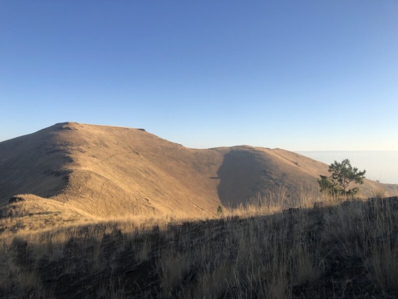
It was a cold morning, the air had that first cold crisp feel of fall and we happily walked along a gravel road, along the way we found a few running springs a good sign that future hikers will have a good reliable water source. We slowly climbed until we finally hit the Rim wall and the actual trail, we easily walked along a well-maintained trail, we gleefully walked through the well-spaced trees and enjoyed the views of Hells Canyon, yet we still could not see the Snake River somewhere down there.
The wind finally died down and then the clouds parted, and the sun came out. We stopped on some logs for a snack, we had a cell signal so we each check in with home. It was on that call that my wife informed me that the previous night’s wind had set off a series of wildfires as close as Estacada (a small town just outside the metro area). She said multiple areas were being evacuated and the sky in Portland was a hellish seen of smoke and fire tainted sky. We told her to keep us posted and to stay as safe as she could.
The next few hours were some of the most pleasant miles one could ask for, we walked in and out of groves of ponderosa pine on the rim of Hells Canyon, each time getting a new view of this massive and impressive landscape. We ran into a few bow hunters who were camped out towards Lord Flat, the first one we met was on a bike and he told us about seeing some wolves the previous day, damn I really want to see a wolf on this trip. A few miles later we were accosted by an aggressive dog who was guarding their large camp. After a few shouts the owner was finally able to wrangle the dog away from us. Man what a camp multiple wall tents, ebikes for getting around, and a corral full of mules. These guys were dug in for a while on this hunt. The one guy we chatted with told us he came in by plane and landed at lord Flat where we were headed. After a little chatting and a water fill up at the spring we carried on our way.
We arrived at Lord Flat, I wasn’t really expecting what it would look like but before us was a massive flat on the rim, with a grass landing strip running off towards the Snake River. We looked across at the Imnaha Canyon and then tried to figure out where to go. As we navigated through the chest-high grass, we felt a bit put out that it wasn’t easier to find our trail. We headed toward the only clump of trees we could see and when we arrived, we hit our trailhead to Dug Bar down on the Snake River.
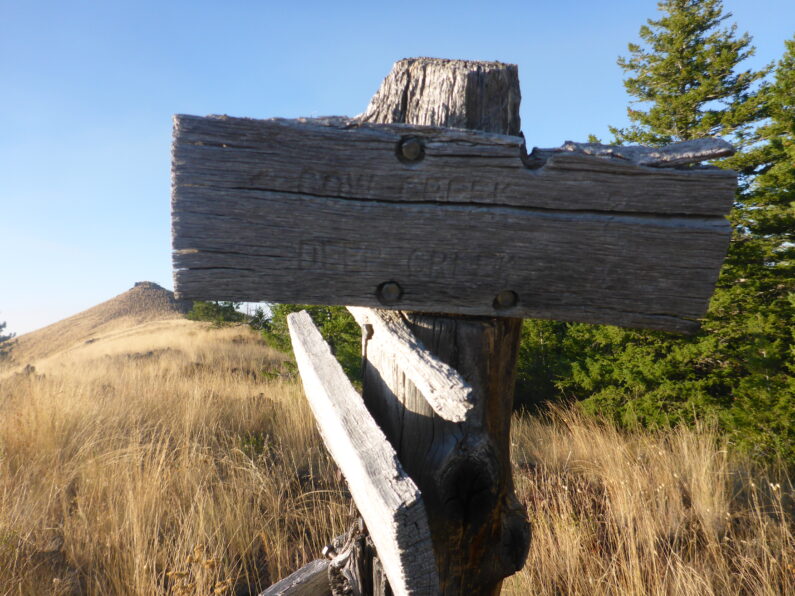
We snacked on some food and had a short break, then after wishing we could stay, we threw on our packs and started the descent, we only dropped a little elevation and then before us saw a magnificent long ridge walk. The trail could be seen skating just below the rim, undulating up and down depending on the topography. We each set out, for some reason I was out front, and like a little mt goat I picked my way along the trail. We came to Fingerboard Saddle and to our surprise there was an ancient trail sign stating Cow Creek Trail, we knew we would cross Cow Creek sometime tomorrow, what to do. We consulted our maps trying to decide which way was better the planned route or this new alternate. We did notice the trail passed right thru a ranch, the ranch was along rectangle of private land in the middle of this public area, and decided we should stick with our original plan.
We walked along the rim trail slowly climbing and descending with each mile. The sun was starting to drop and as dusk fell upon the mountains, we walked along the narrow path thousands of feet above the canyon floor. The hiking was a bit slow going as the crumbling tread made us stay hyper vigilante of where to place our feet. As the sun finally set and darkness fell, we crossed a small saddle and came into a sloping meadow with some trees on the edge. We scouted around for about 15 minutes and finally decided we weren’t going to find a flat area so sleeping on a slight slope would have to do. FeMike and The Punisher tucked up by the trees and I set up a little bit away in the high grass. We made camp, chowed down some dinner, and sacked out for the night.