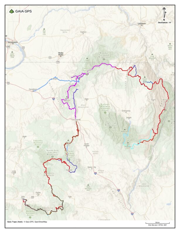
BMT Day 6, Wind Is on the Way
PO Saddle Campground to Memaloose
20.91 miles, 4,022’ Elevation Gain, 3,264’ Elevation Loss
When we got up and turned on my inreach I had 3 messages from Mike Higgins and my wife Suzy warning me to be careful with the wind today, with that I sent out a ping with my location for a weather forecast. It was then we learned that we had a major wind event headed our way, the potential for rain and colder weather, the wind though was the concern the forecast stated that later in the day/evening 35 mph winds with gust over 50 mph, and here were in the exposed country on the rim of Hells Canyon.
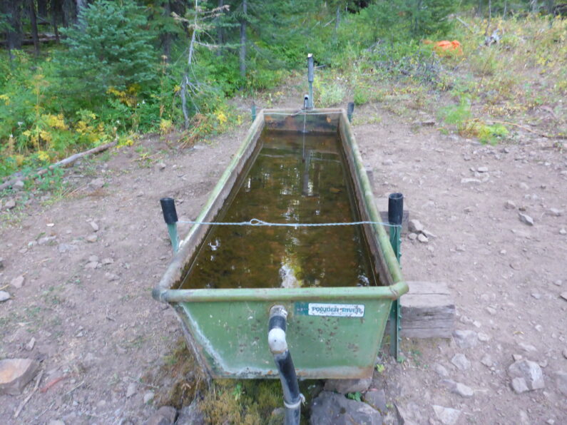
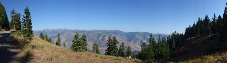
We all loaded up our packs with essentials for the day and tossed our gear in Ron’s van for another day of slackpacking. We left early with plans to meet Ron up at Memaloose at the end of the day. We started out the hike along an old road and the miles came easy this road is actual part of the Western Rim National Recreation trail, but with o cars it was just a very enjoyable wide trail for us. We found lots of water along the way which was unexpected and also noticed a lot of clouds building over the Seven Devils on the other side of the canyon. We hiked along noticing the shift in weather, the wind was increasing, and the temp was dropping fast.
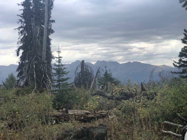
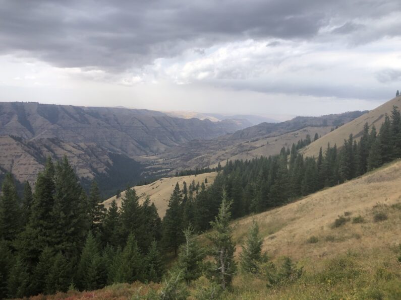
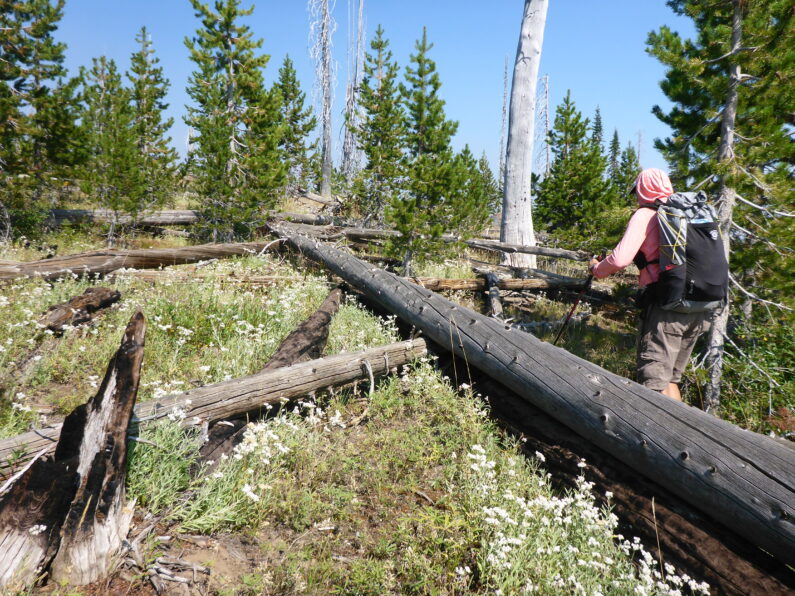
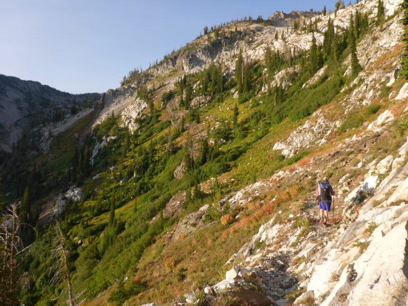
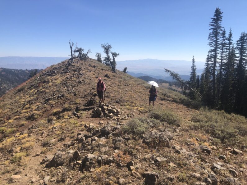
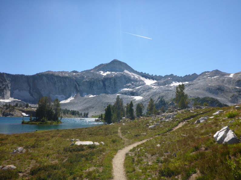
We stopped at an old USFS/cowboy cabin for water and lunch. We had hoped to get out of the wind but there weren’t really options for that we put on some layers and sat there munching away. After we finished lunch, we figured we better get in some miles fast before the weather gave us a wallop, we had to get to Ron for our shelters so without any hesitation we loaded up and started to pound out the miles. The road became a trail and we followed it along the canyon rim until it dropped is onto a long arm connecting one-fold of Hells Canyon’s wall to another. The landscape was stunning and stopped briefly on freeze-out saddle for a quick photo. As we began our climb back up the rim a cold rain started up, not enough for a rain jacket but enough to be happy I had my umbrella. The views were with amazing views of deep canyons below and forest above on the rim all it under a wonderfully gray layered sky.
Right as we came up on the rim and hit the road, the rain got a bit stronger and then the hail started to hit us. We quickly dropped or packs and scrambled for all the layers we had to bundle up from the weather, crazy to think that a few day earlier we were suffering in nearly 100 degree heat, but so goes life in the Blue Mountains.
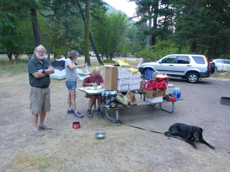
We passed a campground on the side of the road and carried on, a mile later saw Ron walking down the road towards us, he let us know the van was just up the road for a break. When we hit the van Ron gave us some cold cokes and mm’s, not just any mm’s though Carmel mm’s maybe the greatest flavor yet. We downed the sodas, loaded up our pockets with candy and sent Ron up the Road to Memmaloose where we would end the day.
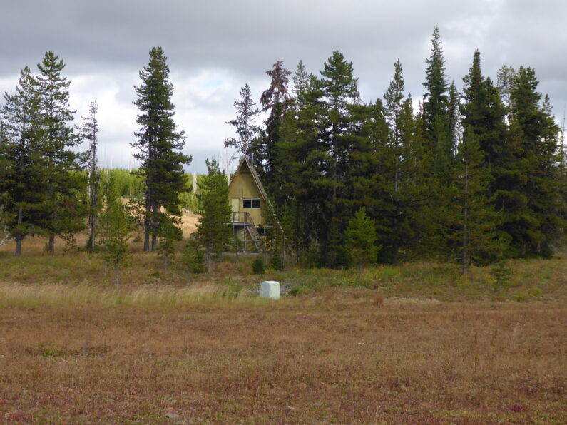
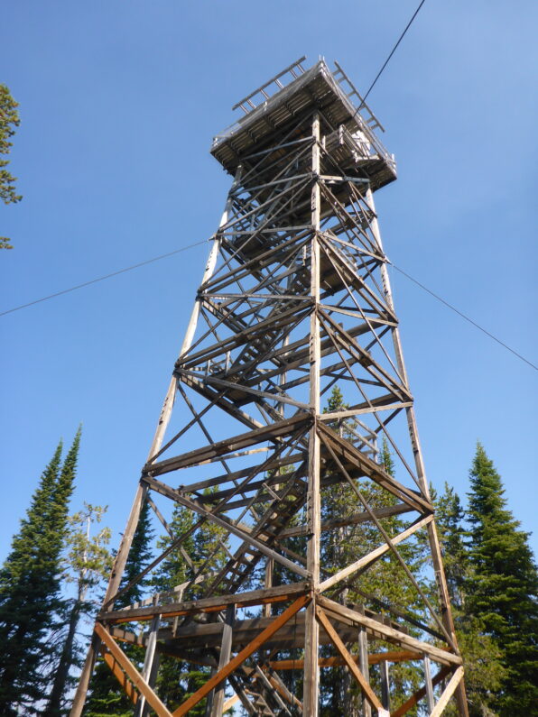
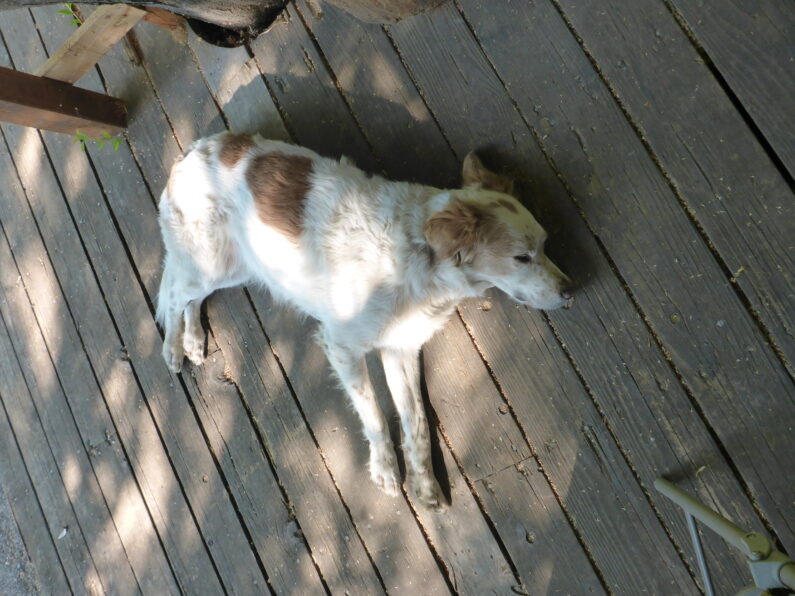
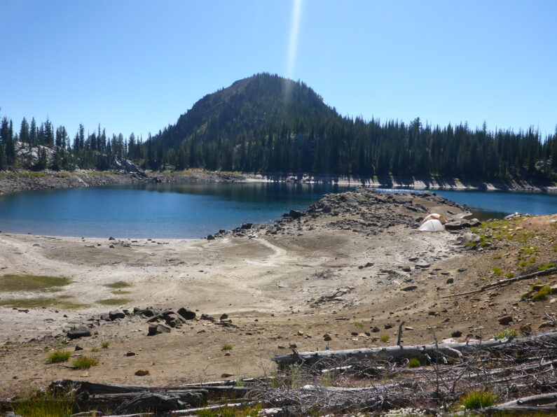
The air was now cold and the wind was really picking up, no time to sop because when we did we got chilled to the bone in an instant. We hiked fast wanting to get to a safe camp away from trees for the night. We turned a corner and saw Ron at the end of the landing strip up at Memmaloose (form what I could tell Memmaloose was a pretty big USFS center that can handle planes and probably large fire crews when needed) The three of us scrambled into the warmth of the Van and Ron drove us a few miles up the road to a Hat Creek Rim Fire Tower, while sitting there we noticed a campground down below the fire tower. Sacagawea Campground was a decommissioned campground for car campers, but it did have a big open yet rocky area in the middle of it that was flat and best of all away from any big trees. The strong winds had arrived and were steady at 30mph and gusting up to 50mph just as predicted. With some hiker ingenuity, lots of rocks, and some extra guylines the three of us managed to get both the tents up, stash our sleeping gear, and then we ran the 50 yards back to the van for shelter from the wind.
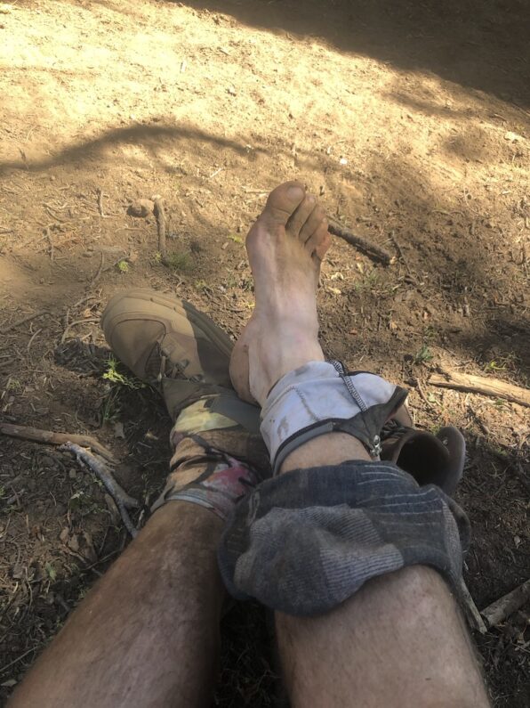
Now the 4 us hung out in the van, we used Ron’s tea kettle to heat up water for our dinners, and we sat around chatting. The 4 of us swapped stories of the worse storms we had hiked through or been pinned down by for a day in the mountains when hiking. We snacked on some dessert and reluctantly left the warm van for what was sure to be a sleepless night in the wind. As I tried to sleep the wind was about as bad as I have had it, the gust would start with a low grumble as they worked up the canyon and then sounded like a freight train as it came into camp and battered our shelters. The wind kept pushing my tent canopy into my face and between the small bits of sleep, I laid awake in my tent holding on and saying a prayer that my rocked over guylines would hold until morning.
BMT Day 5 Hell Canyon Here We Come!
Cold Springs to PS Saddle Campground
Miles Hiked 22.1, Elevation Gain 2,552’, Elevation Loss 2,221’
Today started with so much hope for easy hiking and trails, but alas that was not to the case. After an early wake-up, coffee, and quick pack up we loaded our extra gear in Ron’s van and decided to use the opportunity of having his support to lessen our loads for the day. We parted ways with plans to meet at the Hells Canyon Overlook at some point that day and then we started down the dirt road. We then turned on what was a trail on our map, but the trail quickly became a series of defunct roads. We scouted down one of them, but it petered out, so we decided to try the one we were one, we chose poorly. In about a mile the road became a jumbled mess of blowdowns and brush, we tried our best to pick our way through it, reminding ourselves that as long as we made forward progress, we were ok.
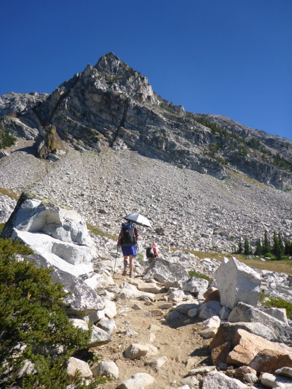
After what felt like hours of climbing on a jungle gym we finally found a trail, and it was a good maintained trail and even had cairns marking the way, hooray. We hiked along for about a mile and then checked our bearing and realized we were back tracking to Cold Springs where we had camped, bugger. We turned around and followed the trail the other way, it was pleasant, and we made fantastic time. The trail dumped us out on a paved road up to the Hells Canyon Lookout. We walked the pavement waving to cars as we climbed up and up to the overlook on the rim.
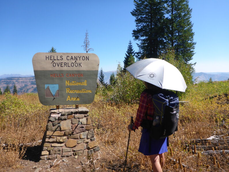
We arrived at the overlook right at the heat of the day, there was no shade but there was a privy to use and a fair amount of tourist. We sat in the shade of the van and enjoyed cold sodas and Gatorade, we raided Ron’s fridge for sandwiches and veggies and then snacked on bars and trail mix. While there we started to talk to some tourist who were into ultra-light backpacking, after going through a pack fitting of our packs, and showing them our umbrellas, they tried to buy them off us, ha! After a way too long of a break we decided to head out for the last 11 miles of the day.
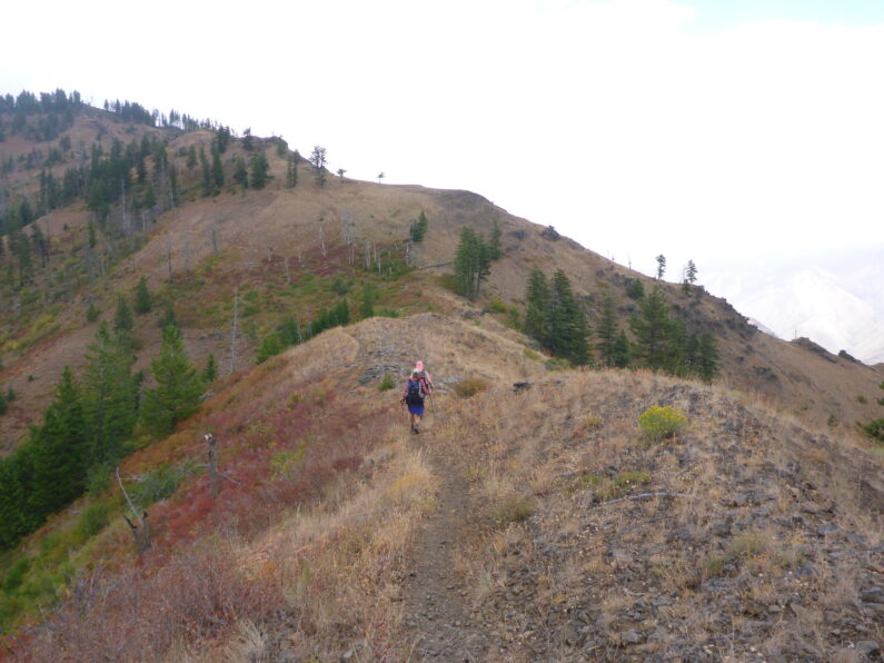
We left the overlook and followed a series of well-maintained gravel roads along the rim of Hells Canyon. FeMike is also our hiking coach and he loves to see how much we can push our pace, so he set a goal of sub 20-minute miles for the rest of the day and the game was on. As we pushed our pace, we enjoyed stunning views of the canyon and forest, the road walk allowed the three of us to walk together and talk about life, and how we could solve the world’s problems. We discussed music and history and when there was nothing left to say we let our minds wander and got lost in our own thoughts.
We rolled into camp just before 6pm, there was still plenty of daylight, but the gate on the road after the PO Saddle Campsite prevented Ron from going farther. So, we called it a day and set up camp, I opted to cowboy for the night as it was so pleasant out and I wanted to be able to star gaze at night. Today was Ron’s birthday, so we enjoyed a nice night in camp cooking salmon and a steak for Ron, with fresh asparagus and salad. As the day turned to night FeMike and The Punisher turned in and I sat out with Ron enjoying the night sky and chatting, eventually my eyes got heavy and I turned in for the night.
BMT Day 4, Mike Higgins Gives Us a New Path Forward
Start Fish Lake TH, End Cold spring
Miles Hiked 14.72, Elevation Gain 1,608’, Elevation Loss 2,694’
Sometimes you just need a local person’s knowledge of an area to set you on the right course and work out the kinks in a plan. We woke up and enjoyed one of the best breakfasts I have ever had, homemade French toast casserole, bacon, fresh fruit form the area, and endless cups of coffee. After eating up a storm, Mike pulled out a series of maps for Hells Canyon and the area and started reviewing our route versus what he thought we should do. With many years of hiking in the area, his and Donna’s knowledge was invaluable. We poured over maps and after much back-and-forth discussion we plotted out a new route that not only kept us in the high country but also avoided a very long paved road walk.
Ron lent us his computer so we could map out the new route in Gaia and then send ourselves the new GPX files since we did not have a way to print out a whole new set of maps. With our new route Mike did warn us that a few areas might not have trail anymore or if there they could be in rough shape form fires, but hey what else is new. After getting ourselves sorted out, we chatted about the next time we might see Mike and Donna, and much to our surprise hey offered to resupply us in Troy, OR in a about a week, little did we know this was close to a 5 hour drive each way, but I’m getting ahead of myself.
We snapped a few photos and then loaded up in Ron’s van to head back to the trail, as we left Mike handed each of us a copy of the book he wrote about the El Dorado Ditch, Ditch Walkers and Water Wars, we thanked him and Donna for all they had done for us, tucked our books away for when we got home and hit the road. The Road Back to the trail was a bit of a rough go, we bounced along gravel and winded our way back up to Fish Lake for the next hour, poor FeMike turned green form car sickness, but luckily held it down on the ride. We poured out of Ron’s van and while we got ready to go, he made us each ham and veggie wrap for the trail.
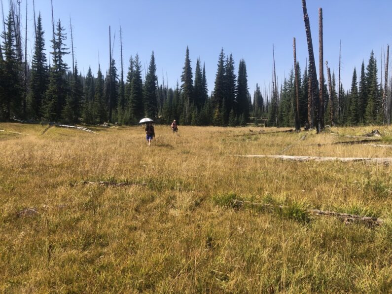
Our new route started out walking the USFS road for a bit before we turned off onto the old trail that led up to Russell Lookout, this would help us avoid a long walk on the Paved and busy USFS 39. We walked up the gravel road chatting away and getting passed by a few folks in their side by sides, the air was warm, the sun was shining, and we were all enjoying his relaxed road walk and the good pace we were making. Once we made the Outlook, we started looking for the trail shown on the old map Mike had lent us, but it wasn’t there. We backtracked on the road to a clearing and luckily spotted a trail sign, and rejoined the new route.
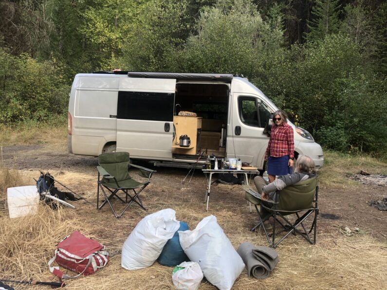
The trail would appear and disappear as we walked through a meadow, after losing it more than a few times, we sucked it up and started the inevitable bushwhacking before us, after a while, we found the trail again and carried on. After our walk through the woods the trail came back to the road we were on earlier and we followed it to the now-defunct road to Duck Lake. We strolled gently uphill along with a series of old dirt roads chatting and joking the whole time, man how lucky I am to spend time with people I love out in the wilderness especially give all that 2020 has handed us. We were really enjoying ourselves especially since we knew Ron would be waiting for us that evening at cold springs. As the sun was starting to get low, we turned the corner and alongside the road in a small opening was Ron and his trusty van waiting for us. Now generally a hiker would kill for a picnic table to sit at after a day of hiking, but Ron stepped it up with big camp chairs, cold beers, and a BBQ ready to go for us.
We set up our shelters and then wasted no time in enjoying ourselves. We cooked burgers, drank a few beers, and spent the next few hours sharing stories from all of our years on trail and discussing the current state of affairs of the ultra-light gear world. What a great way to wind down, just 4 gear nerds who love hiking talking gear and hiking until the starts came out.
As I drifted off to sleep, I heard some animal rustling off in the woods, luckily, I sleep like the dead, so I just rolled over and drifted off to dream land. When the Larm went off at 4:30 the next morning I saw the evidence of last night’s visitor a large cow pie right by my tent.
BMT Day 3, Meeting a Trail Visionary
Start Upper Pine Lake
End Fish Lake Trail Head
Miles hiked 18.42, Elevation Gained 3,346′, Elevation Loss 4,222′
We got up before first light and packed up and started down the trail to meet Ron at Cornucopia lodge where he was waiting for us to arrive. The trails were stunning and right out of the Sierra with granite peaks around, lovely switchbacks. The temperature was hot and even before the sun was up high in the sky, we were sweating even going downhill. Eventually, the trail dropped and then took a turn into the forest, ad little ways down that trail and we spotted two hikers climbing towards us. We stopped and chatted a bit and they said, “are you the 3 hikers trying to do the BMT?” We told them, Yes’ and they went on to tell us how much they loved Mike and Donna who we would be meeting tonight.
We parted ways with our new friends and kept trucking along, eventually the trail gave way to an old roadbed, and we followed that out along a creek. We emerged from the trail into a dirt parking re and spotted Ron in his van waiting for us. He plied us with cold drinks and chips and then we decided to save ourselves some hassle and slack pack the rest of the day.
We took off with plans to meet Ron in Halfway that evening, where we would all go to Mike and Donna Higgins’s place for dinner, and a stay-over. We started by walking some dirt roads, the roads climbed but the grade was not too bad. We came to a saddle and the entire road was covered in wolf prints in the dirt, so wild, and again we all said how much we hoped to see a wolf on this trip (the blue mountains hold the highest concentration of wolves in Oregon). We kept up a decent road and that eventually gave way to an old road that was a little rougher.
We climbed and decided to take a quick break in the shade before pushing on. We laid there under some trees munching away on dried mangos, jerky, and other snacks, then we strapped on our packs and carried on. In a few 100 yards our trail disappeared, and we found ourselves having to route find up a steep slope under a hot sun. the forest turned from trees to a very burned over area form a forest fire. As we trudged along slowly, we hoped things would improve since we had a 4 pm pickup scheduled at Fish Lake.
We ascended the hill and stood atop a saddle looking at the burnt over valley below, luckily there was a cairn and trail so we started down it, yet as we got closer to the bottom the trail disappeared into a mess of blowdowns and burnt trees so we picked our ay trying to locate the trail. Eventually, we came to the revisor, we were all out of water and thirsty, so we took a. Short water break.
As the water filtered away, we snacked and did the math on how fast we needed to go to make it to Fish lake to meet Mike. We loaded up the water into our packs, threw them on and started to jam out on a decent trail. The trail was nice the rest of the way and we were able to make some good time, we finally joined an old dirt road and easily cruised to the parking lot where Mie was waiting for us.
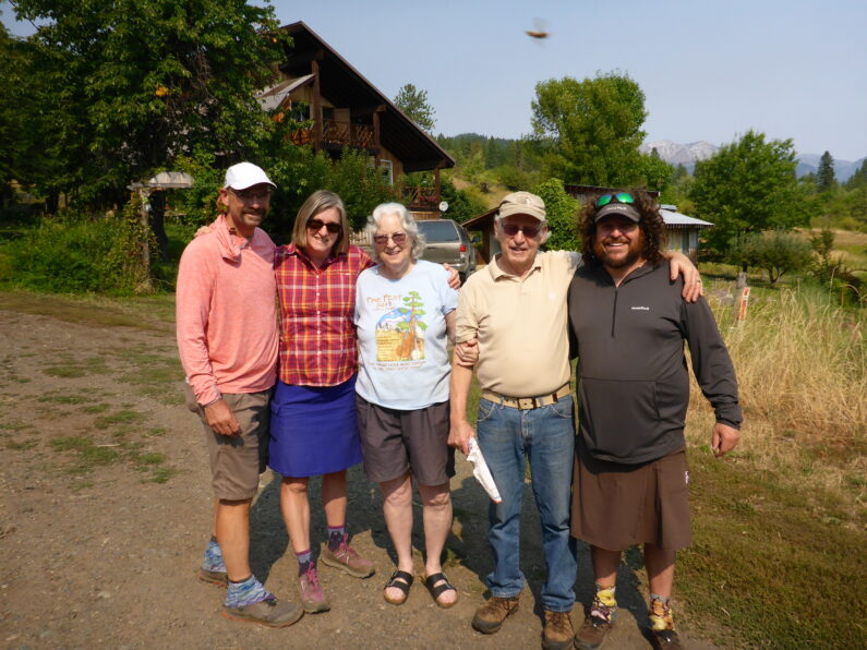
Mike was thrilled to see us, we chatted and introduced ourselves then he asked what we wanted to drink, cold beer or soda. FeMike and I went for a beer each and The Punisher had a soda. We munched a bunch of chips and chatted about the hike and the hot weather. Finally, after a while, we loaded up in Mike’s truck for the hour-long ride to his place. We bumped along the dirt road and Mike stopped to show us where we would be hiking the next day and a few alternates we may consider. We finally arrived in the small charming town of Halfway, OR. We saw Ron and had him follow us to Mike’s house.
Mike and his wife live on a wonderful piece of property with a small orchard and plenty of space. Their two dog Scout and Finn were very curious about these smelly hikers who had entered their property, but after a few sniffs, we were all friends. Donna is an amazing cook and we sat down to a homemade Indian style chicken curry with bread, it was delicious. For dessert, we enjoyed homemade peach cobbler and then we headed up to our private part of the house where we bathed and did laundry before passing out for the night.
BMT Day 2, Will This Climb Ever End?
Start Eagle Fork Horse Camp
End Upper Pine Lake
Miles Hiked 19.01 Miles Hiked, Elevation gain 4,347’, Elevation Loss 3,261’
We awoke early, man it felt great to get so much sleep the night before, my body really needed it to recover after yesterday’s butt-kicker. I walked up above camp to take care of the daily AMBM and low and behold 100’ from where we were camping there was a great big camp spot with lots of flat areas. Our camp last night was small and a bit sloped tucked up in the bushes, oh well that seems to be how it always goes when you roll into camp at dusk.
I had a quick coffee and packed up as fast I could so we could be on our way. A few miles down the trail and we came to a junction with Moon Lake trail which was marked in our data book at 19 miles however our GPS showed almost 22 miles hiked since the start, after some discussion we determined that the data we were operating off of might not be accurate, so we would need to keep that in mind going forward.
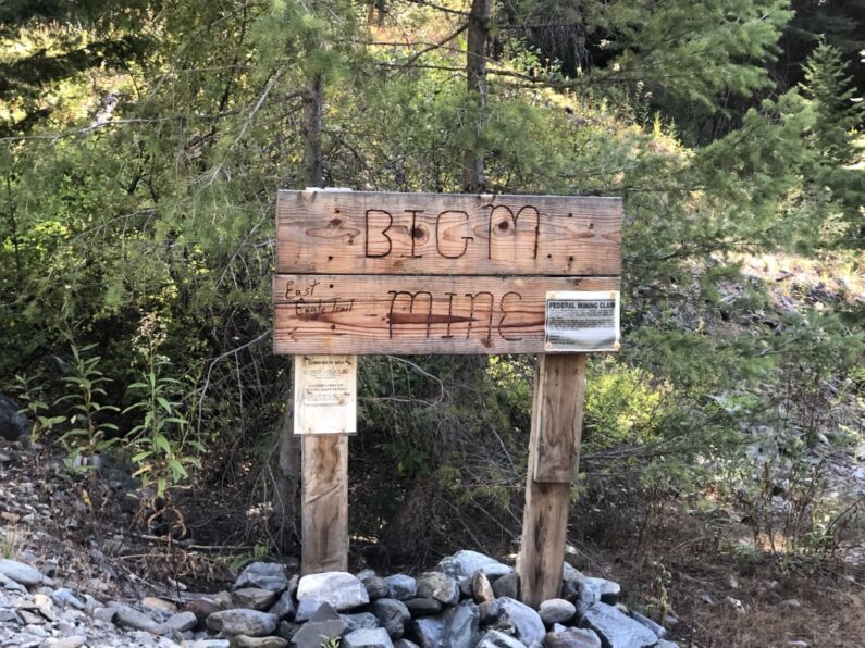
We descended down through the valley and the large meadows turned to forest eventually, as we dropped into the valley floor we came across Big M Mine, which appears to be somewhat active, why we sell off our public lands for this type of destructive activity will never make sense to me. We arrived at a USFS parking area for a few trails that started in the area. We chowed down a second breakfast, cameled up on some water, and filled our water bottles for the upcoming climb which showed 3,100’ over 4.5 miles. With the weather getting hot we started up our climb at 10:45 am.
The climb was beyond tough, it was sunny and wicked hot without a breath of air to be found. We trudged along at our own pace each of us lost in our own thoughts as we grinded up the endless switchbacks. The terrain was steep, rocky and the shade was pretty scarce, as I looked up ahead, I could see FeMike crushing the climb and The Punisher not too far behind him.
All of sudden my gut gave out a gurgle and I all of a sudden had to stop for a pooh. I enjoyed the unexpected break and then set off to finish the climb. Little did I know that I was about to climb and climb and climb on an endless rocky expanse with the sun cooking me from above and from the radiant heat from the rocks below. Due to some overhanging brush, I snagged my umbrella on a branch and snapped a rib, dang now I had to climb with the sun beating down on me. The climb never ended. I looked at the data book when I had started below, it said 4.2 miles, yeah, I must be close…then I turned the corner and saw The Punisher trucking up a rock face a few switchbacks ahead. Good golly Miss Molly, where the hell is this lake? Finally, I crossed the pass and walked by a couple of ponds that looked inviting, and then I crossed over a rise and came upon Crater Lake a true-blue gem of a high alpine lake. I dropped my pack and walked down to where FeMike was sunning himself on a rock after a swim.
In an extremely rare moment in life, I stripped off my shirt and shoes and jumped into the ice-cold water, it felt great and refreshing! We laid around eating lunch and lamenting about the databook mileage being off and how long the climb was. As we looked at our maps we discovered an alternate we could have taken that would have kept us above 6,000’ of elevation and have avoided the long descent and ascent we had just done, my good friend She-ra was planning to do this route in October so maybe she can try it on her hike.
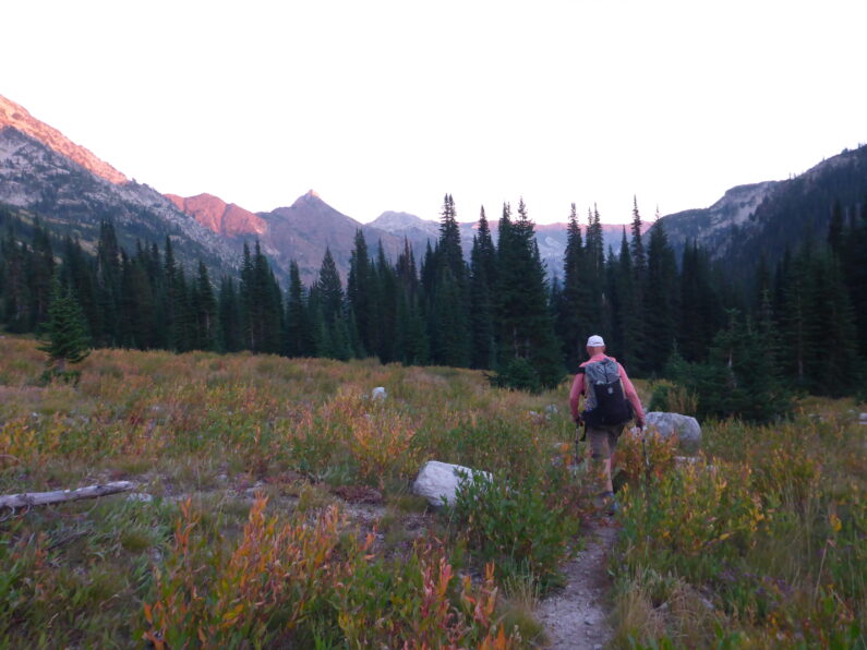
We walked along the high country traversing wonderful rocky ridges and taking in the beauty, however, our joy was a bit deflated when we realized what we had to postpone our meeting that evening. Mike Higgins one of the founders of this trail, had invited us to his house for the night for dinner and a shower, however looking at our maps we realized we could never make it. We got to Pine Lake pass and got a cell signal, so we called Mike to rescheduled for the next day. We now had 10 miles to go to the road crossing at Cornucopia Lodge, being 4pm we decided that instead of killing ourselves we would hike the 3.5 miles to Upper Pine Lake and call it early for the day to get some rest and recover from our hot climb earlier in the day.
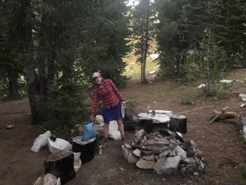
We found an amazing campsite above the lake with rocks arranged to sit on and cook on, flat spots to set up our tents, and easy access to the water. We all sat around eating and joking with each other, being such good friends really helps when you have a tough day like this, and laughter truly is the best medicine. Before dusk turned to dark, we all climbed into our quilts and fell fast asleep, 4:45 am comes early so we knew we needed to rest and recover to take on whatever tomorrow had in store for us.
BMT Day 1, The Journey Begins
Start Wallowa Lake Trail Head
End Eagle Fork Pack Trail Junction
Miles Hiked 20.17, Elevation gain 5,322′, Elevation Loss 3,392′
The night before we arrived at Wallow Lakes State Park where we met Ron who had been on the road traveling around Montana for the past month. We caught up on the happenings, started making some plans on when and where to meet us, and enjoyed a lovely dinner before calling it a night.
After a bit of a slow start in the morning cooking breakfast, sorting last-minute items, and breaking down camp. I said goodbye to Suzy and Karluk as they headed out for a scenic drive to Boise to visit an old friend of ours. The three of us loaded up in Ron’s van and headed for the trailhead and the start of our hike. The weather was a little cloudy and cool, but the forecast said it was about to get hot later that day. We unloaded from the van and put on our packs which we all lamented were too heavy, but that is always the way the first few days out. We headed to the registration box for our wilderness permits and on the way up the road I spotted a triple crown series of stickers in a red Toyota and I said that to myself, I think that’s Aladdin’s truck he must still be out here hiking the Wallowa’s.
Ron walked up to the start of the trail with us and took a few photos of the 3 of us and said goodbye as he headed the opposite direction on his day hike. The trail was really nice, it climbed slowly along the creek and about 4 miles in it started to slowly gain elevation as we followed the creek. We turned the corner I was happily surprised to see Aladdin hiking towards me with another couple that FeMike & The Punisher had met while hiking the Great Enchantment Trail a few years back and I had met at PCT days when I was manning the booth for ALDHA-West. The 6 of us stood there on the trail catching up about their hikes and ours and all of us lost in thought in how small of a world that long-distance hiking, here we are on a new route yet we could still run into people that we know.
We continued on our way enjoying the nice trail and chatting as we hiked along finally it was time for a lunch break, we pulled off the trail and ate knowing that the next stretch was a doozy as we had to climb up and over Glacier Pass. As we gained elevation, we crossed over treeline and into the alpine zone. Before my eyes lay a sight to behold, high alpine lakes and steep rocky granite peaks, I could have easily been in the Sierra or the Wind River Range, instead, I was in my own state. How it ever took me 20 years to come hike in the Wallowa’s was beyond me.
The climb was kicking my butt though, mile after mile of grinding uphill certainly let me know I was not quite in tip-top hiking shape. COVID hasn’t been the best for my exercise regiment, and after all the issues I had after the ODT in 2018, those 10 months of little activity while I worked to fix my foot cyst was catching up to me now. I cursed myself for not getting after it more during the weeks leading up to our departure date. I was in the caboose position and as I looked up, I could see FeMike and The Punisher making easy work of the climb up to the pass.
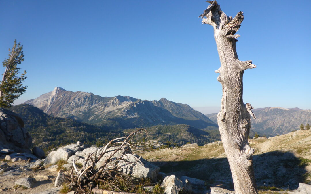
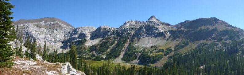
Finally, after what felt like hours the three of us stood atop Glacier Pass and marveled in the beauty that surrounded us in 360-degree panoramic view worthy of any postcard. The enjoyment and thrill of making our first pass quickly faded as we had to descend into the next drainage before our next climb up to Horton Pass and the side trail to Eagle Cap Mountain.
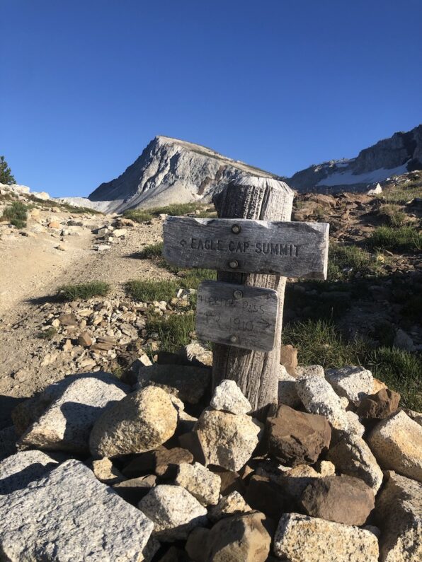
As we descended, we walked by numerous high alpine lakes and said hello to the hikers camped out along their shores, after a quick water stop to top off our reserves, we started our climb up Horton Pass. The climb was strenuous, and I had to dig deep within myself to keep putting one foot in front of the other, the day had stretched well into the afternoon and I knew I had to keep pushing myself so we could make camp by dark. I made a false summit and was bit deflated mentally but up ahead I could see FeMike getting close to the pass, so I sucked it up and pushed hard. I finally joined FeMike and The Punisher at the saddle to Eagle Cap, and the three of us had a quick snack and gazed upon the beautiful granite peak that the Eagle Cap Wilderness it is named after.
As I sat there munching away on a bar, I reflected upon the story of the Nez Perce people and how hard they fought to keep the sacred land as part of their territory. I now understood why Chief Joseph’s people refused to give up their ancestral claim to this land and I could imagine them living happily in a place of such beauty with steep peaks and wonderful meadows that provided them all they needed to live happily for a millennium. It was a moment that would repeat itself over and over for me on this trip, a mixed bag of being elated to be out here, but knowing full well I walked on upon hallowed ground with an extremely sad history, to say it conflicted me would be putting it lightly.
We left the saddle and climbed the last few hundred vertical feet up and over Horton Pass, and began our descent into yet another sea of majestic mountains and granite. We had to be careful as the terrain was loose and slick, made of fine scree that has the same consistency of walking on ball bearings, with each step sliding as you go along. Finally, we dropped down into a stunning alpine valley and found a suitable place to camp right as dark fell upon the mountains. We set up shelters and began our camp chores; filtering water for that night and the next day’s needs, we cooked our dinner, wrote down some trail notes, and reviewed our plan for the next day. FeMike and I share the same mindset of being planners, so having a plan for the next day not only helps us stay on track but also helps to mentally prepare you for what is ahead.
As the full moon rose, I crawled into my tent and under my quilt, my body was sore but in a good way and laying down felt wonderful. I shut my eyes and drifted off to sleep quickly with happy thoughts racing through my head, I was finally back on the trail, and the excitement of exploration was taking hold inside of me. The pre-hike jitters had faded away and I felt at home as I lay there in the wilds.
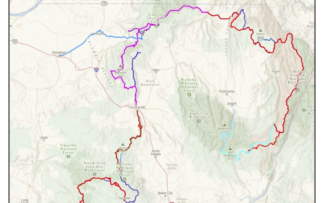
Blue Mountain Trail
In September of 2020, I and 2 friends tackled a new route being developed in Oregon called the Blue Mountain Trail (BMT). The trail is a 588-mile route that takes a serpentine course through the Blue Mountains of NE Oregon, one of the most rugged mountain ranges in our state. The Blues as they are called in Oregon, have a long and storied history in our region. These mountains were the ancestral home to the Nez Perce People, who through a sad history eventually lost this land and were later pursued by the US army in one of the saddest sagas of our countries persecution of native people. If you want to learn more about this event in time, I highly recommend the book, Chief Joseph and the Flight of the Nez Perce by Kent Nerburn
This route is being developed by the Greater Hells Canyon Council, as part of their ongoing work in the region. Originally thought up by Loren Hughes, Dick Hentze and Mike Higgins; the original idea was a Camino de Santiago type route where people could hike from BNB to BNB with all the luxuries like slack packing and nights spent enjoying warm food, cold beer and a soft bed. However, after many years it was decided that instead of having people view the Blues from afar, it would be better to let them experience the blues by immersing themselves into the mountain range.
Jared Kennedy formerly of the Outdoor Project has been working hard to map this route out for GHCC, and through some mutual connections, like Renee Patrick of ONDA, I was put in touch with Jared to help with their ground-truthing efforts on the route. However, since I love to thru-hike more than day hiking, after some talks with Jared with numerous warnings that he didn’t think it was ready for the thru-hike I said what the hell and decided to go for it anyway.
Knowing that staying safe was paramount for me and others I may encounter I devised a plan to hike as safe as possible during these crazy times. Wanting to limit my in-town time was paramount and given the remoteness of where I was going would make this easy. An added benefit to hiking in my home state was a great support network. Friends and family to help me and partners along the way. My boss Ron “Falling Water” Moak was more than willing to come out for the first 2 weeks to be our mobile bounce box so to speak. Ron would carry our resupplies for the first two weeks and meet us periodically along the way to resupply us with food, charge our electronics, and make us some awesome meals to fuel us up for our next stretch of trail. Luckily Ron has a new Dodge Promaster Van that he built out in 2019, this trip was not only a great escape for him but also an opportunity to continue to shake down his rig for his around the world drive when it’s safe to travel internationally again.
Hiking During COVID
2020 has been a weird year for sure and even weirder for the long-distance hiking community in the US. Back when the pandemic started the hiking community started to eat their young and for months anyone still on a trail was referred to as plague rat, and threats and insults were made online with the favorite mantra being, “thanks to your selfishness my grandma is going to die”. Knowing this I myself canceled my own 2020 plans, a thru-hike of the Arizona Trail. With so much uncertainty this year, and a spike in infectious rates in AZ I knew that going down there was not an option for me for this year, or the type of thru-hike I wanted on the AZT, I knew this was the responsible thing to do. Then like a light switch come summer the long-distance hiking community switched their opinion on hiking and instead of hordes of hikers on the big three trails AT, PCT, and CDT folks flocked to shorter hikes like the Colorado Trail, Arizona Trail, and the Tahoe Rim Trail. All of a sudden it was Ok and cool to be back on the trail. Still, I had no desire to be around tons of hikers or people for that matter during these times, so the thought of tackling a trial no one had done become even more alluring.
Other plans to stay safe included, mailing ourselves packages later in the trip to save time and limit exposure in towns, carrying and wearing masks when we encountered other people, and making sure we all practiced good hygiene while out on trail. Lastly staying close to home allowed us to travel in a car to and from the trail with my wife Suzy being the driver, and also having the safety net of being able to be quickly extracted and returned to home if needed.
I know that any hike has its risks especially during a pandemic, but after weighing the risk, formulating a plan to minimize said risk, I figured this was my best option to get this year and satisfy my itchy feet.
Hiking Partners

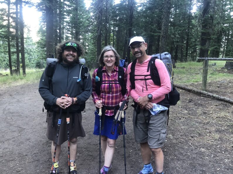
Since this hike was going to be full of challenges, any time you are the first to hike anew route these challenges are compounded because of so much unknown, I knew I would rather have some company. Together we would be able to enjoy the suffering together, help each other along the way with route finding, and also spend some quality time as a team working out solutions to problems as they arose. My two hiking partners for this trip were my close friends Mike “FeMike” Unger and Naomi “The Punisher” Hudetz, are some of the coolest and most accomplished hikers I have the pleasure of knowing. FeMike and The Punisher have hiking resumes that include 3 triple crowns between the two of them, multiple hikes on the Arizona Trail, Pacific Northwest Trail, Great Divide Trail, and a slew of other hikes that would take days to list. Besides being badass hikers the two of them are both super level headed, extremely intelligent, and two people that set the best example of what to strive for in life, a balance of independence from societal norms to pursue what you are truly passionate about, for all of us it’s walking for hours at end in remote places.
Since the pandemic started FeMike and The Punisher are some of the only people I have seen or done activities with this year. This spring we all decided to jump into the bike world and bought bike packing rigs. Over the spring and summer, we took some bike packing trips together and chatted about their canceled plans for 2020 and their desire to get out for a hike somehow. The more we spoke about the BMT the more we knew we needed to go tackle this together.
Knowing that a month of challenging route finding, and hiking can take a toll on the best of friendships, I felt that this was a minimal risk. I had the pleasure of working with The Punisher for years together on the board of ALDHA-West, in addition, the three of us and some other friends had done a shorter hike a few winters back on the Trans San Diego County Trail, and from that weeklong hike we all knew we would get along fine on the trail. So, with a plan in place, maps and data books printed, and a desire to get out and explore our state, we departed Portland on September 2nd to Joseph, OR, and the start of the BMT